Mini Lesson/Activity
Kuril Islands Volcanoes
Overview
Compare images from two volcanic eruptions in the Kuril Islands which occurred ten years apart and complete a graphic organizer for impacts on different Earth spheres.
Student Directions
Steps
-
Examine the images to complete a graphic organizer and answer questions. Check with your instructor on how to submit answers.
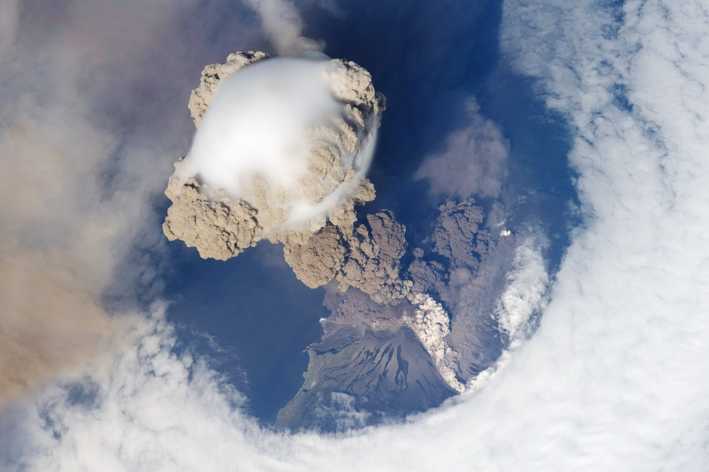
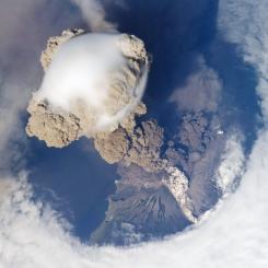
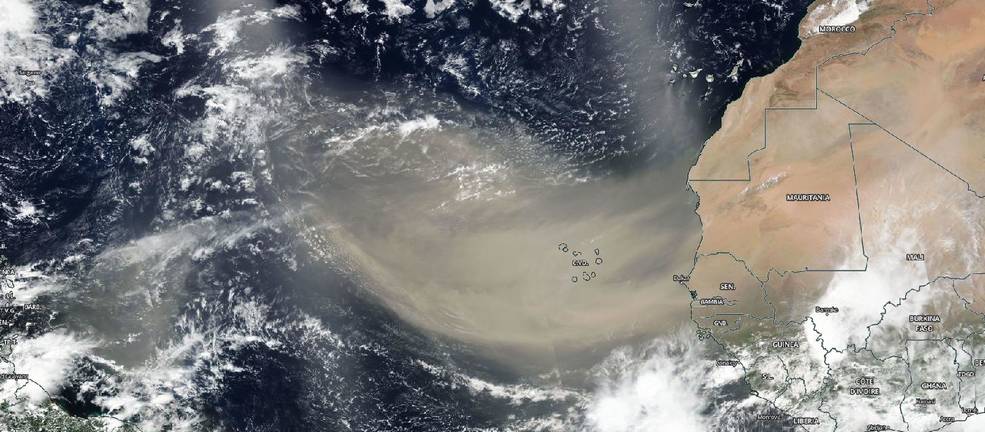
Sarychev Eruption June 12,2009
Image Credit: NASA
https://mynasadata.larc.nasa.gov/sites/default/files/inline-images/Sarychev_0.jpg -
Examine the image snapped from the International Space Station of the Sarychev Volcano in the Kuril Islands which are northeast of Japan. It is a photo of an early stage of eruption on June 12, 2009.
My NASA Data Earth System Graphic Organizer
https://mynasadata.larc.nasa.gov/sites/default/files/2019-08/Earth%20System%20Frayer%20Model%20V.5_Graphic%20Organizer.pdf -
Describe the impact you think the eruption could have on the Earth spheres: Atmosphere (air), Biosphere (living things), Cryosphere (ice and snow), Geosphere (land and soil), and Hydrosphere (water). Use the graphic organizer provided. NOTE: You will be filling it in for another image as well. Plan to use a different color or font to tell them apart.
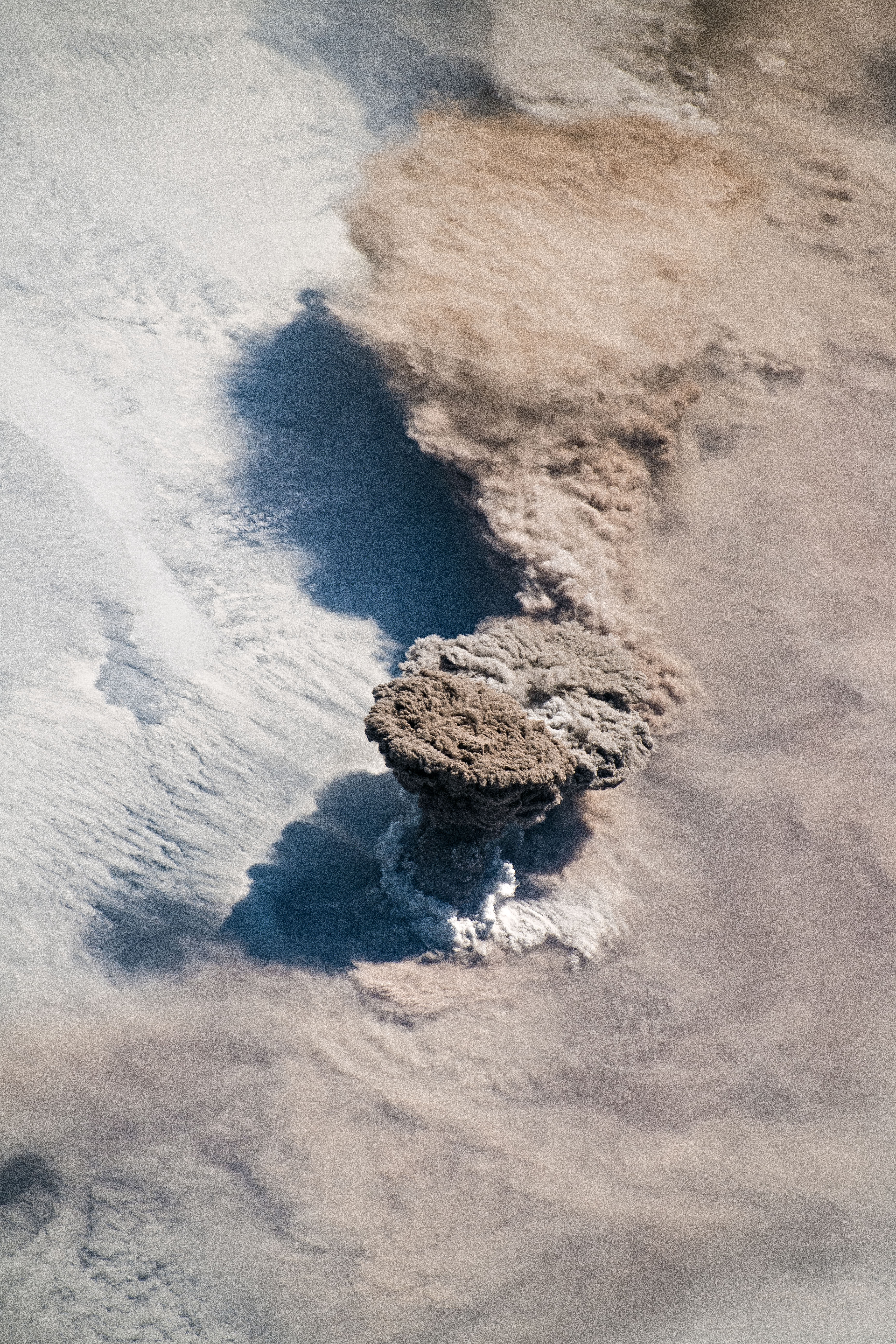
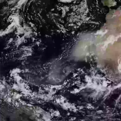
Raikoke Eruption June 22, 2019
Image Credit: NASA
https://mynasadata.larc.nasa.gov/sites/default/files/inline-images/Raikoke_1.jpg - Now, examine the image (also taken from the International Space Station) of the Raikoke Volcano, also in the Kuril Islands. This eruption occurred on June 22, 2019.
- Describe the impact you think the eruption could have on the Earth spheres: Atmosphere (air), Biosphere (living things), Cryosphere (ice and snow), Geosphere (land and soil), and Hydrosphere (water). Use the same graphic organizer provided. Record your observations for the new volcano in a different font or a different color.
-
Compare the two images and use your graphic organizer to answer the following questions.
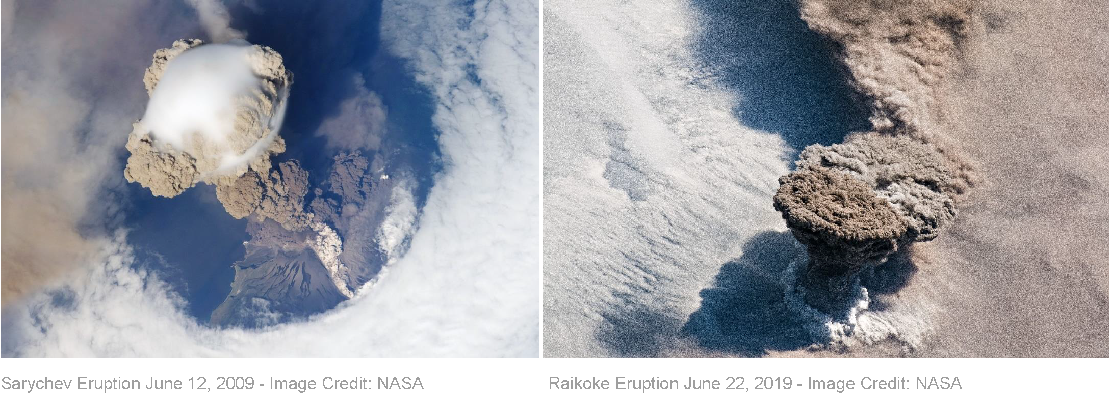
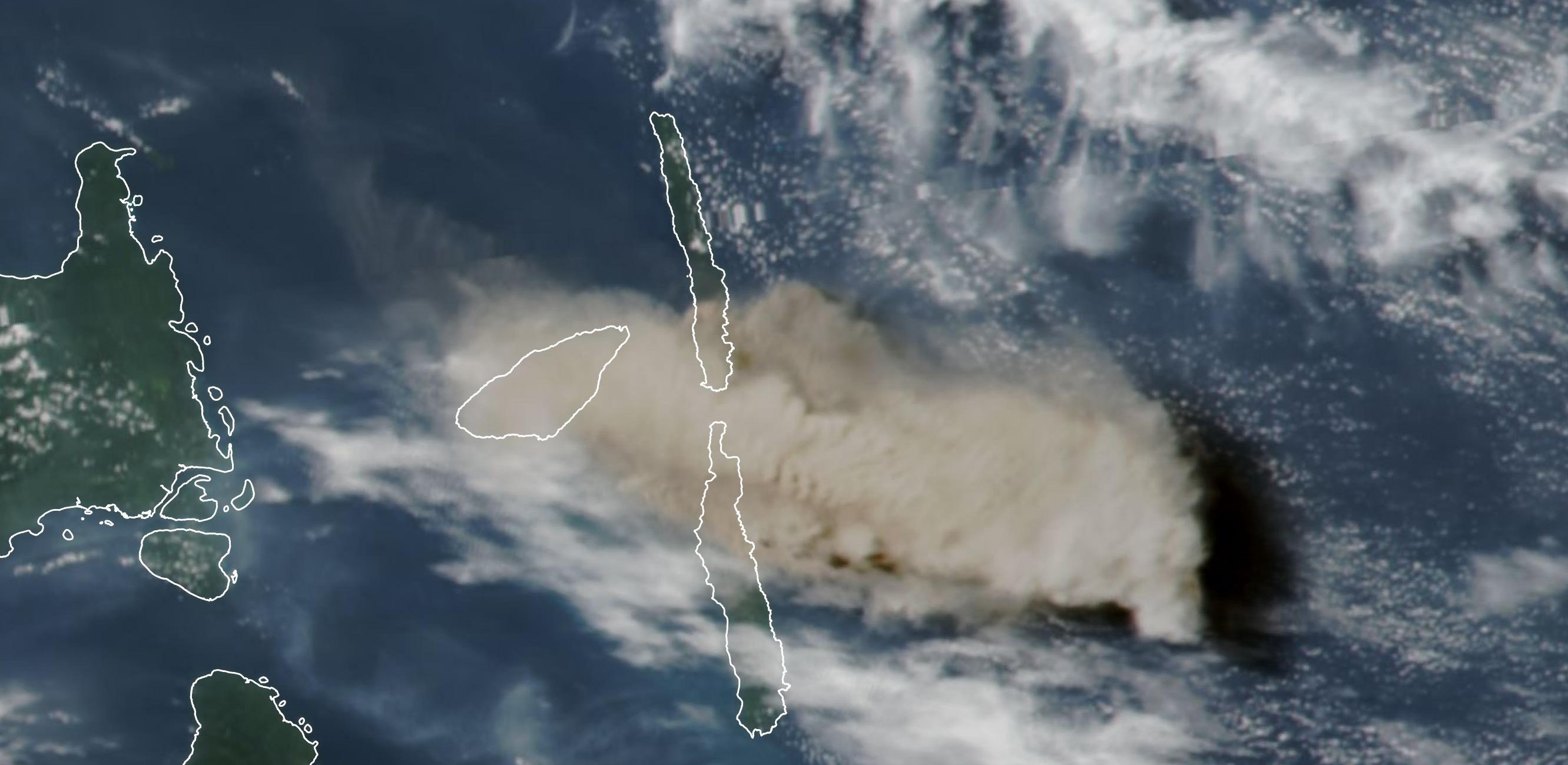
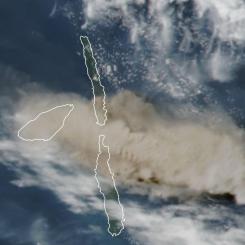
Sarychev Eruption June 12, 2009 and Raikoke Eruption June 22, 2019
Image Credits: NASA
https://mynasadata.larc.nasa.gov/sites/default/files/inline-images/Compare%20Sarychev%20and%20Raikoke_1.png
- Compare the two images. What are the similarities and differences in the images?
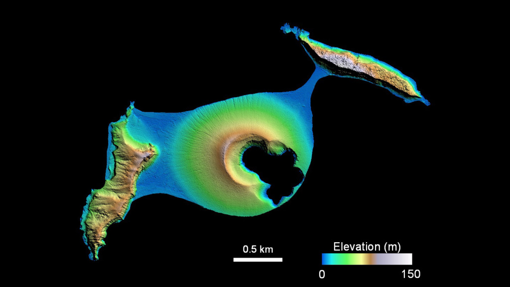
- The volcanoes happened approximately 30 km apart. What does this tell you about the area?
- Make a claim about the volcanoes in the area. Use the evidence from the images and give your reasoning.


Sources:
- Sarychev Peak Eruption, Kuril Islands. (2009, June 21). NASA Earth Observatory. Retrieved April 29, 2022, from https://earthobservatory.nasa.gov/images/38985/sarychev-peak-eruption-k…
- Voiland, A., Klemetti, E., Carn, S., & Prata, A. (2019, June 24). Raikoke Erupts. NASA Earth Observatory. Retrieved April 29, 2022, from https://earthobservatory.nasa.gov/images/145226/raikoke-erupts
Teachers, these mini lessons/student activities are perfect "warm up" tasks that can be used as a hook, bell ringer, exit slip, etc. They take less than a class period to complete. Learn more on the "My NASA Data What are Mini Lessons?" page.
Teachers who are interested in receiving the answer key, please complete the Teacher Key Request and Verification Form. We verify that requestors are teachers prior to sending access to the answer keys as we’ve had many students try to pass as teachers to gain access.
Disciplinary Core Ideas:
- ESS2A: Earth Materials and Systems
Crosscutting Concepts:
- Cause and Effect
Science and Engineering Practices:
- Analyzing and Interpreting Data
- Engaging in Argument from Evidence
Complementary Mini Lessons

Complementary Interactives
Document Resources
Interactive Files
Grade Band
- 3-5
- 6-8
Time
- 30 minutes
Visualization Tool
NGSS Three Dimensional Learning
- See drop-down menu at the bottom of the page