Grade Level: 3-5,
6-8
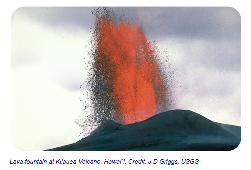
Compare pictures of different volcanoes. Then visit NASA's Space Place to learn about volcanoes and answer questions about volcanic eruptions.
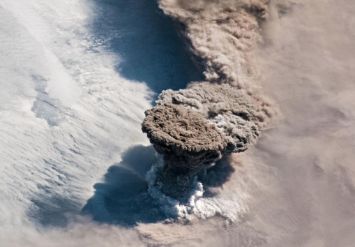
Volcanoes are windows into the interior of the Earth. Through subtle changes and dramatic explosions, they intrigue scientists and often strike fear into societies. Lava flows, pyroclastic flows, and lahars pose great risk to those living in the proximity of a volcano, while large explosive eruptions can affect the entire planet by filling the atmosphere with ash and sulfate particles thereby modify the global climate.


Compare pictures of different volcanoes. Then visit NASA's Space Place to learn about volcanoes and answer questions about volcanic eruptions.

Students will review the NASA Space Place video, "Tectonic Forces", and answer questions about tectonic plates.
Compare images from two volcanic eruptions in the Kuril Islands which occurred ten years apart and complete a graphic organizer for impacts on different Earth spheres.
Watch NASA videos about aerosols and volcanic ash.
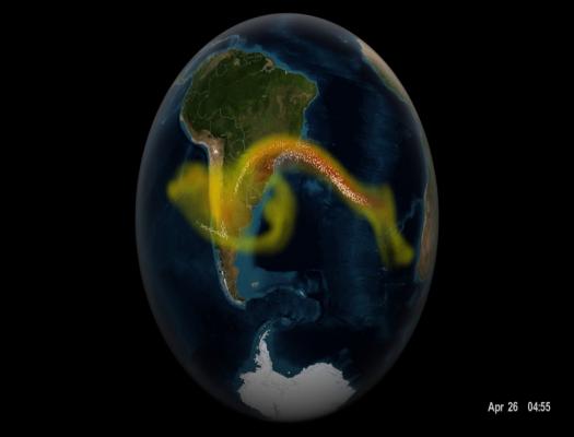
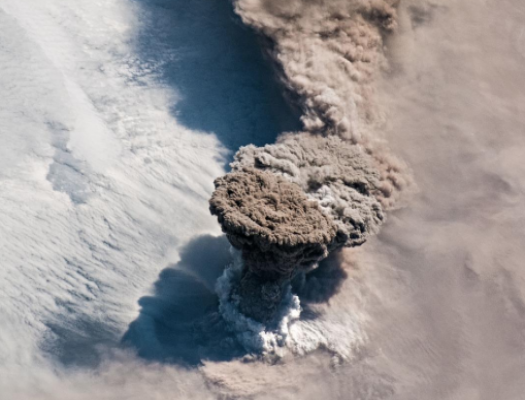
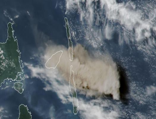
Learn about volcanic ash and watch a visualization of the Calbuco volcano to see how ash travels around the world.
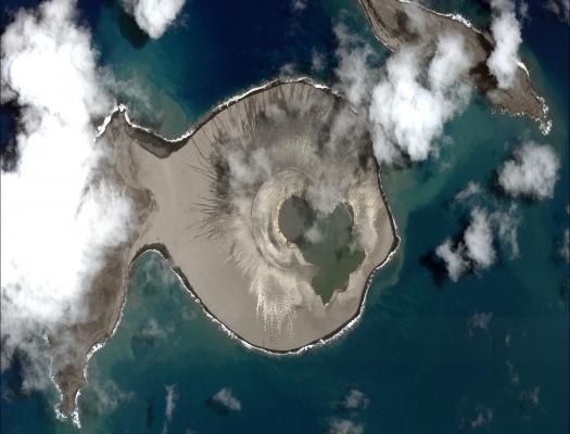
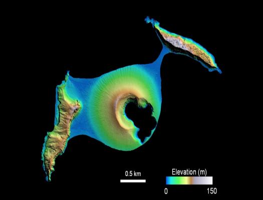
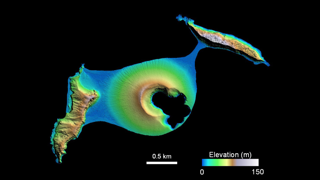
Students will describe the changes in a newly-formed volcanic island over the first three years of its life.
Students examine satellite images of an island before and after a volcanic eruption to determine the impact of the eruption.

Students examine satellite images of a recently formed island to identify areas of erosion and deposition.
Compare pictures of different volcanoes. Then visit NASA's Space Place to learn about volcanoes and answer questions about volcanic eruptions.
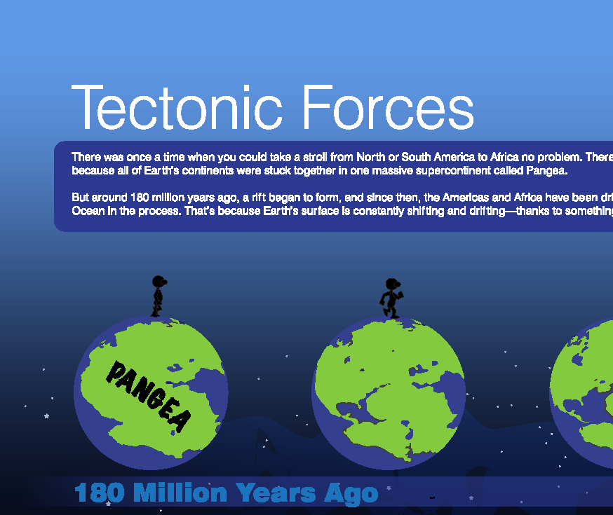
Students will review the NASA Space Place video, "Tectonic Forces", and answer questions about tectonic plates.
Compare images from two volcanic eruptions in the Kuril Islands which occurred ten years apart and complete a graphic organizer for impacts on different Earth spheres.

Watch NASA videos about aerosols and volcanic ash.
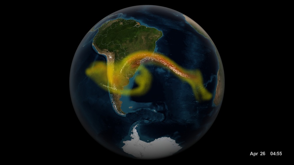
Learn about volcanic ash and watch a visualization of the Calbuco volcano to see how ash travels around the world.
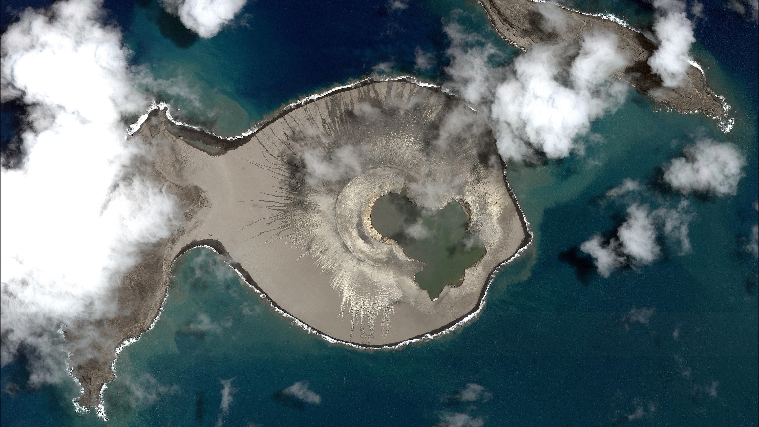
Students will describe the changes in a newly-formed volcanic island over the first three years of its life.
Students examine satellite images of an island before and after a volcanic eruption to determine the impact of the eruption.

Students examine satellite images of a recently formed island to identify areas of erosion and deposition.
