In this mini-lesson, students analyze soil moisture quantities associated with Hurricane Harvey around Houston, Texas on August 25, 2017.
List of all Geosphere Mini Lessons


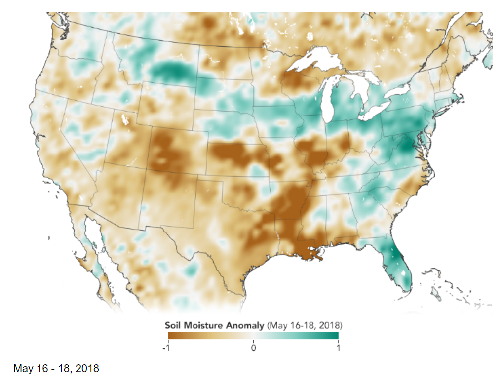
This mini-lesson guides students' observations of soil moisture anomalies (how much the moisture content was above or below the norm) for the continental US in May 2018.
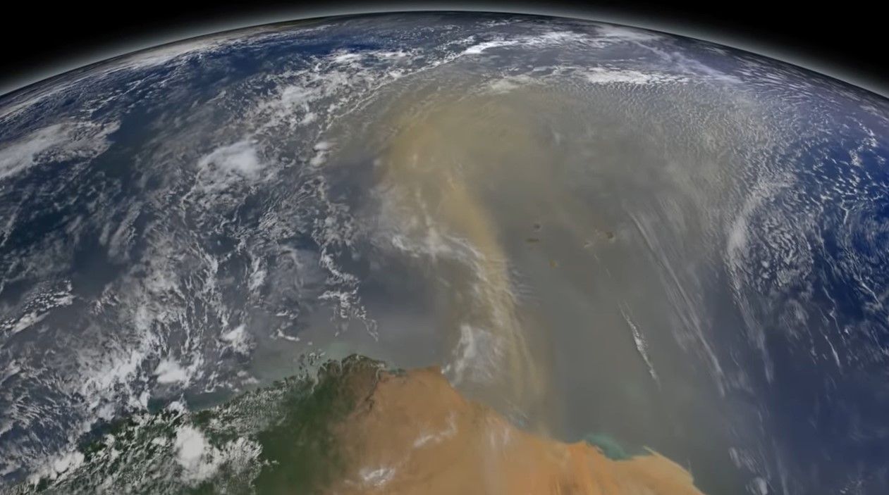
This mini lesson engages students in watching a NASA video related to accumulated dust that makes the trans-Atlantic journey from the Sahara Desert to the Amazon rainforest using NASA's CALIPSO satellite.
Examine the images to see the projected differences in land use between 1900 and 2100.
This mini lesson focuses on Landsat satellite data and how it is used to detect changes in land use.
Compare pictures of different volcanoes. Then visit NASA's Space Place to learn about volcanoes and answer questions about volcanic eruptions.
Compare images from two volcanic eruptions in the Kuril Islands which occurred ten years apart and complete a graphic organizer for impacts on different Earth spheres.
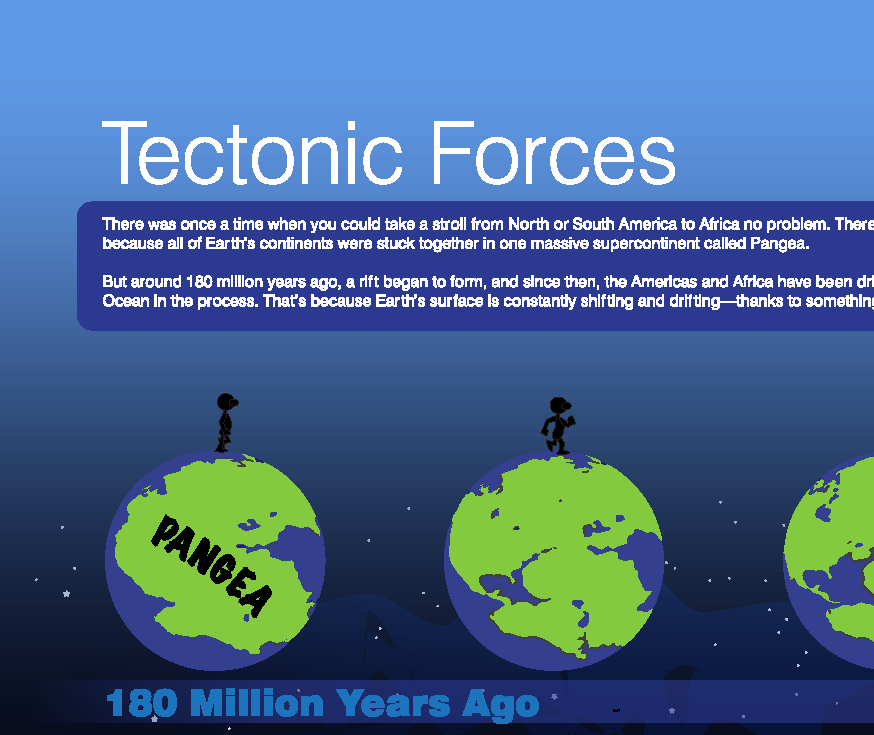
Students will review the NASA Space Place video, "Tectonic Forces", and answer questions about tectonic plates.
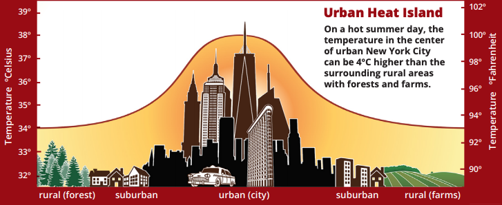
Students interpret a graph of surface temperatures taken from city districts and other types of communities.
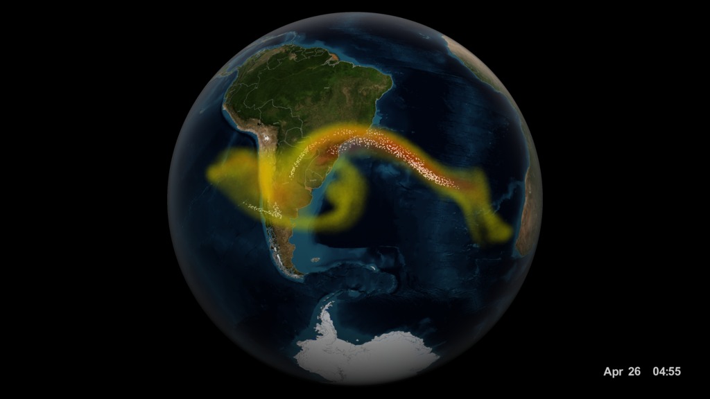
Learn about volcanic ash and watch a visualization of the Calbuco volcano to see how ash travels around the world.


