Grade Level: 6-8,
9-12
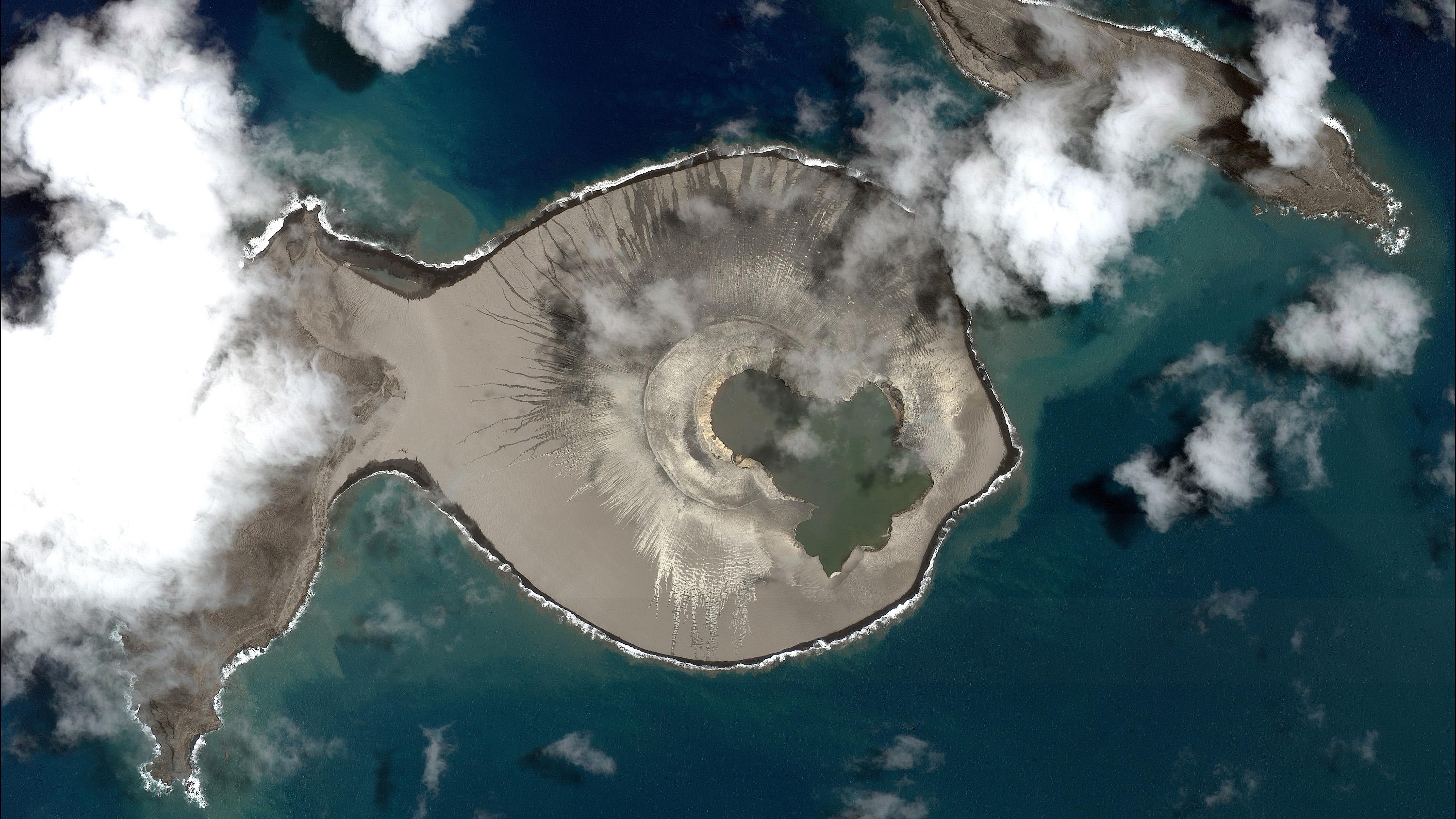
Students will describe the changes in a newly-formed volcanic island over the first three years of its life.
Select a Sphere:


Students will describe the changes in a newly-formed volcanic island over the first three years of its life.

Students examine satellite images of a recently formed island to identify areas of erosion and deposition.
Watch NASA videos about aerosols and volcanic ash.
Help learners envision themselves as explorers, scientists, technologists, engineers, and mathematicians as they venture into the summer months. Download the PDF of the two sided document on cardstock and have students imagine and illustrate themselves!
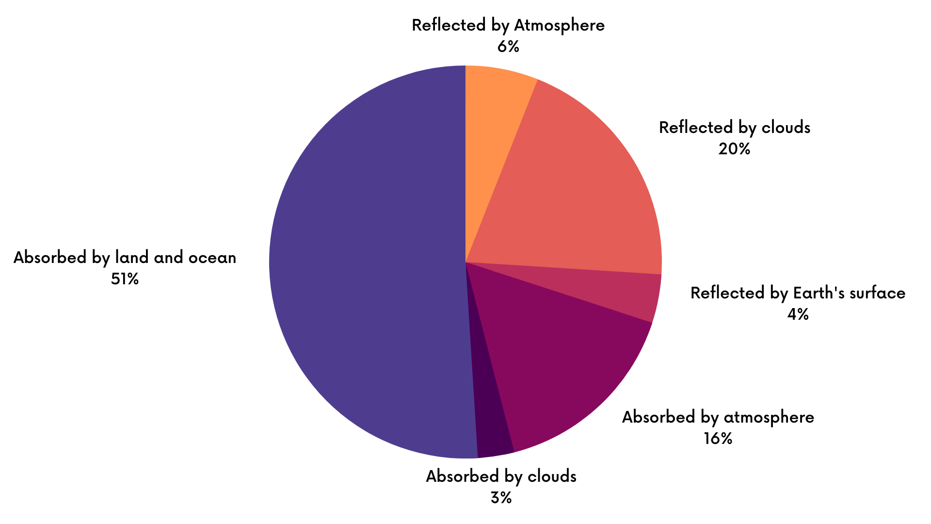
Students will analyze a pie chart (circle graph) showing the distribution of different parts of the Earth system's absorption and reflection of energy.
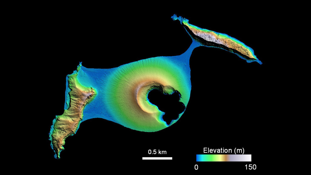
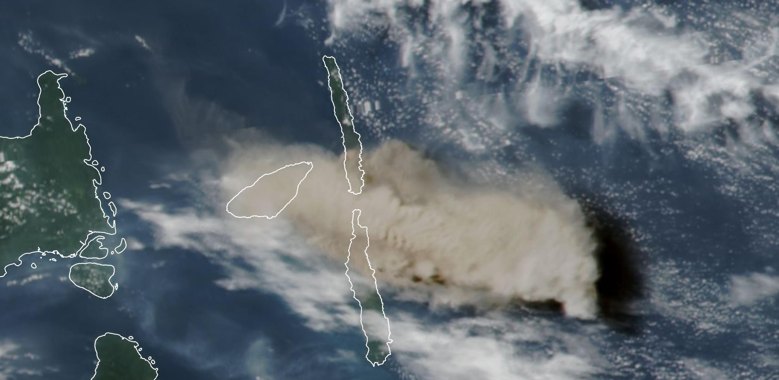
Students examine satellite images of an island before and after a volcanic eruption to determine the impact of the eruption.
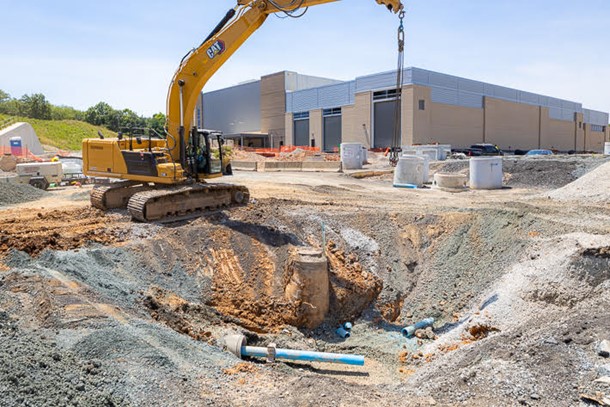
Students will engage in a collaborative learning routine as they explore slides that show how the development of public transportation infrastructure changed the land in Woodlawn, Maryland.
Mini lessons are intended to be short engagement activities that teachers may assign as bell-ringers, exit slips, or parts of larger learning lessons. These include activities where students interact with NASA maps, graphs, and datasets from the atmosphere, biosphere, cryosphere, geosphere, hydrosphere and the earth system.
