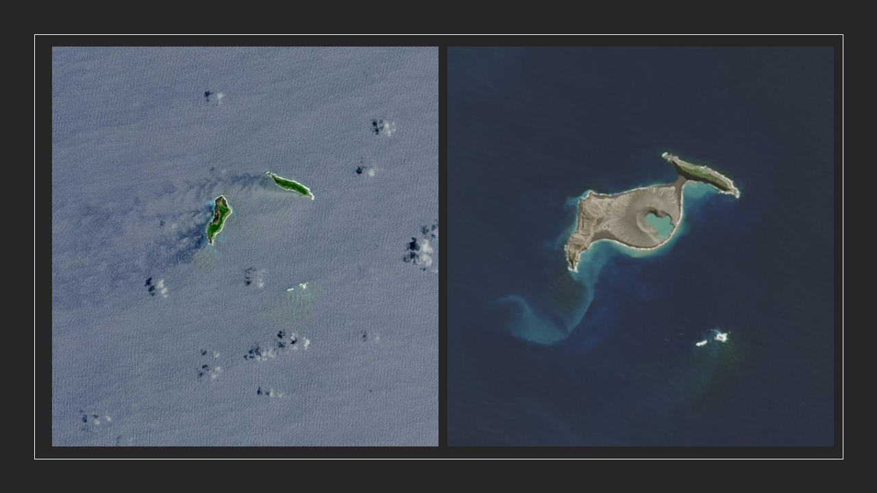
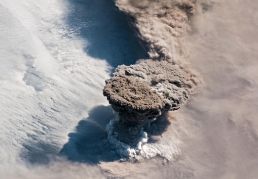
"In December 2014, an undersea volcano exploded to life in the Polynesian island kingdom of Tonga. A month later, when the eruption had ceased and the ash cloud had cleared, experts began to get a better look at what the eruption had left behind—a new island.
The images above were acquired by the Operational Land Imager (OLI) on the Landsat 8 satellite. The [left] image shows the area on December 2, 2013, one year prior to the eruption. At that point, the small islands of Hunga Tonga (right) and Hunga Ha’apai (left) were separated by the South Pacific Ocean. The second image shows the same area on April 28, 2015, four months after the eruption—and the first time that Landsat got a cloud-free view."
Steps
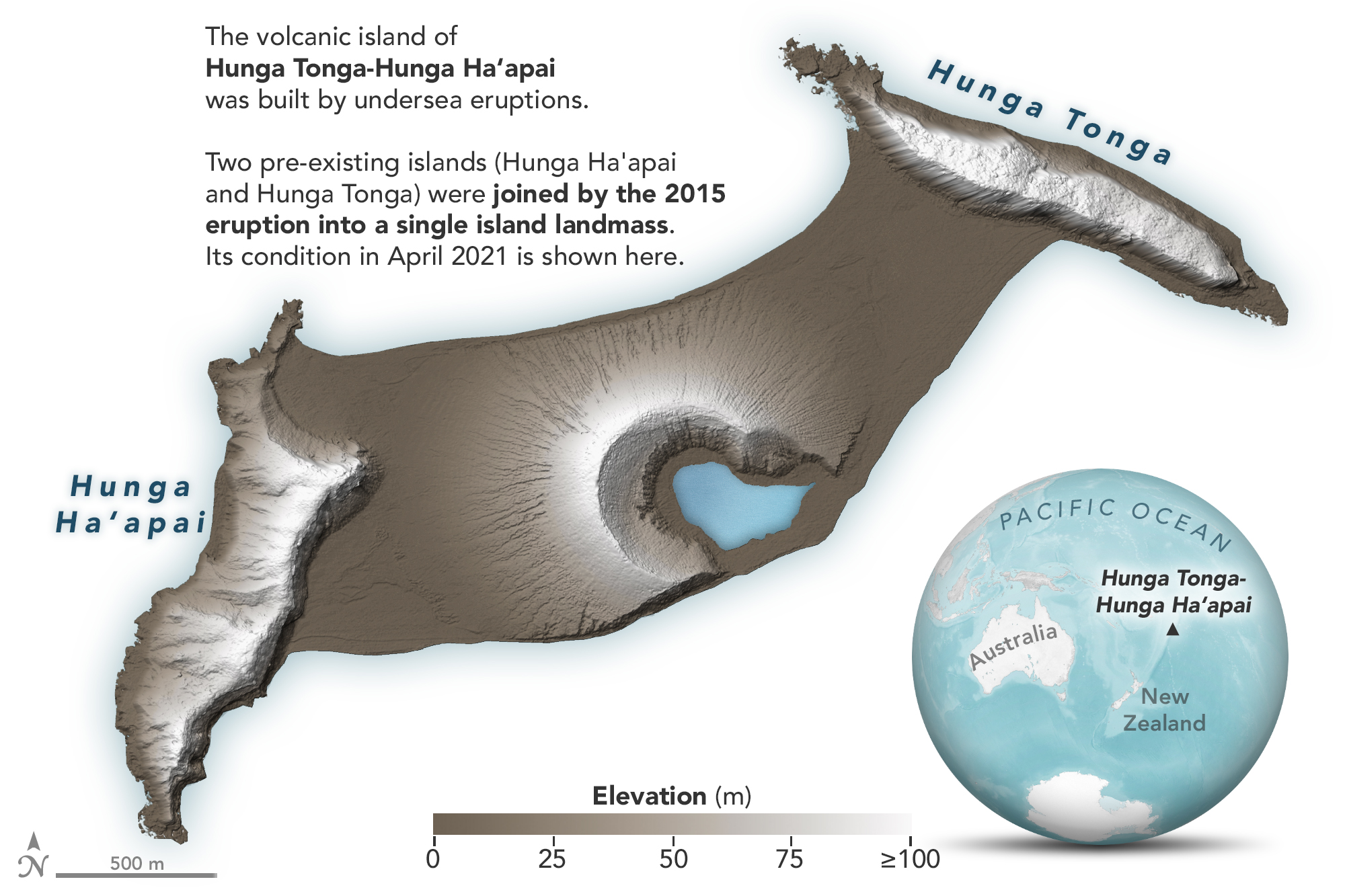
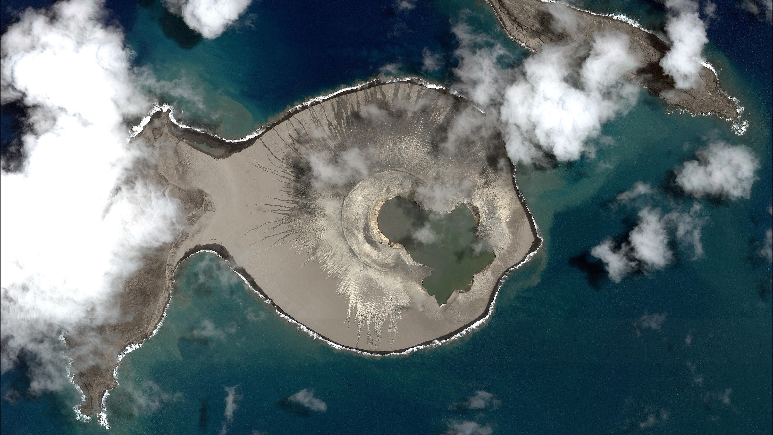
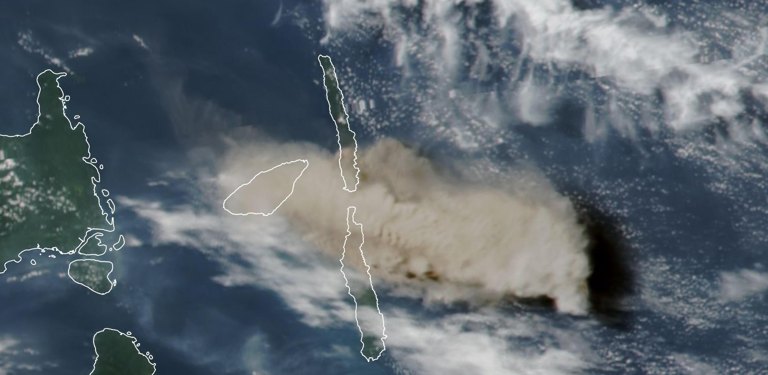
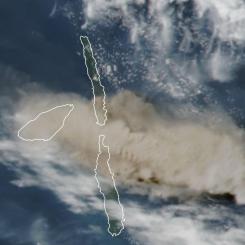
In early 2022, there was a series of volcanic eruptions that resulted in changes to the island of Hunga Tonga-Hunga Ha'apai. The images show the land formation before and after the eruptions.
Examine the images from 2021 and 2022 and answer the questions below. Check with your instructor on how to submit answers.
What sort of changes do you notice in the island?
Do you think the timescale involved in this change is faster or slower than many other areas on Earth?
Can volcanic eruptions cause more than one type of change to land formations?
What evidence is there that volcanic eruptions can impact land formations?
Teachers, these mini lessons/student activities are perfect "warm up" tasks that can be used as a hook, bell ringer, exit slip, etc. They take less than a class period to complete. Learn more on the "My NASA Data What are Mini Lessons?" page.
Teachers who are interested in receiving the answer key, please complete the Teacher Key Request and Verification Form. We verify that requestors are teachers prior to sending access to the answer keys as we’ve had many students try to pass as teachers to gain access.