Mini Lesson/Activity
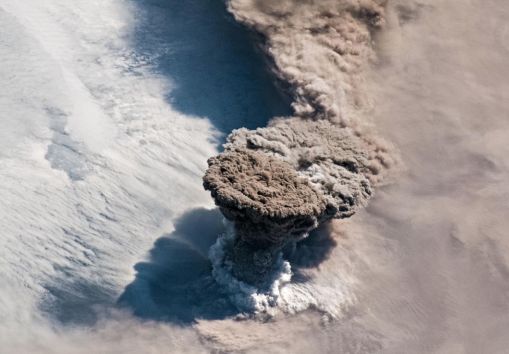
What is a Volcano?
Overview
Compare pictures of different volcanoes. Then visit NASA's Space Place to learn about volcanoes and answer questions about volcanic eruptions.
Student Directions
Steps
- Follow your instructor's directions to work alone or in groups. Check with your instructor on how to submit answers.
-
Examine the images and answer the questions.
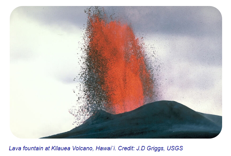
Image 1: Lava fountain at Kilauea Volcano, Hawai'i.
Image Credit: J.D. Griggs, USGS
https://mynasadata.larc.nasa.gov/sites/default/files/inline-images/fire%20eruption_1.PNG
-
Look at Image 1. What did you see in the first volcano image?
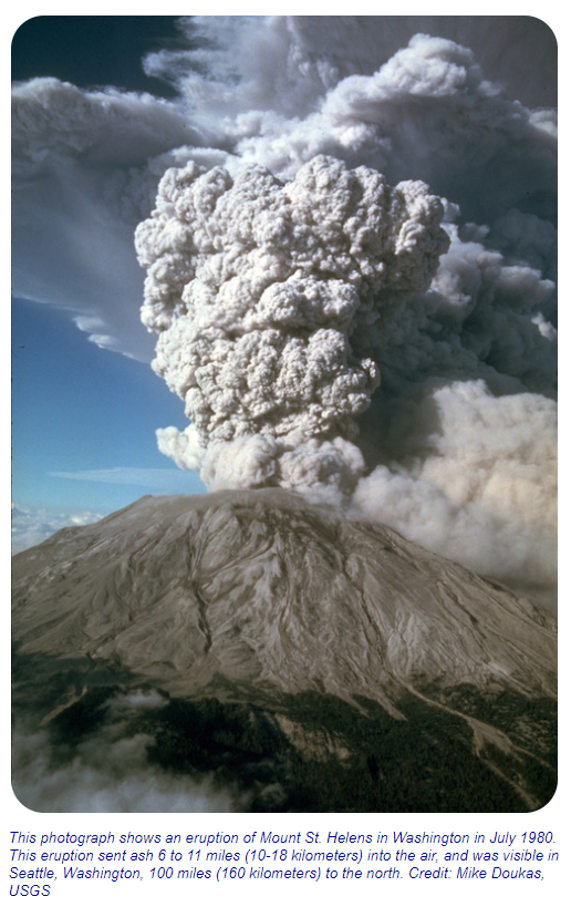
Image 2: Mount Saint Helens eruption, July 1980
Image Credit: Mike Doukas, USGS
https://mynasadata.larc.nasa.gov/sites/default/files/inline-images/Mount%20St%20Helens.PNG -
Look at Image 2. What did you see in the second volcano image?
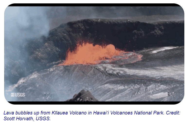
Image 3: Lava bubbles up from Kilauea Volcano in Hawai'i
Image Credit: Scott Horvath, USGS
https://mynasadata.larc.nasa.gov/sites/default/files/inline-images/Lave%20Bubbles.PNG - Look at Image 3. What did you see in the third volcano image?
- How are the three images different?
- How are the three images similar?
-
- Review the introductory information provided in "What is a Volcano?" available from NASA's Space Place to answer the following question.
- What are three ways magma can reach the surface of Earth?


Sources:
- What Is a Volcano? (n.d.). NASA Space Place. Retrieved April 28, 2022, from https://spaceplace.nasa.gov/volcanoes2/en/
Teacher Note
Teachers, these mini lessons/student activities are perfect "warm up" tasks that can be used as a hook, bell ringer, exit slip, etc. They take less than a class period to complete. Learn more on the "My NASA Data What are Mini Lessons?" page.
Teachers who are interested in receiving the answer key, please complete the Teacher Key Request and Verification Form. We verify that requestors are teachers prior to sending access to the answer keys as we’ve had many students try to pass as teachers to gain access.
Disciplinary Core Ideas:
- ESS2A: Earth Materials and Systems
- ESS2B: Plate Tectonics and Large-Scale Systems
Crosscutting Concepts:
- Cause and Effect
Science and Engineering Practices:
- Analyzing and Interpreting Data