GLOBE Connections
GLOBE Connections: Systems and System Models
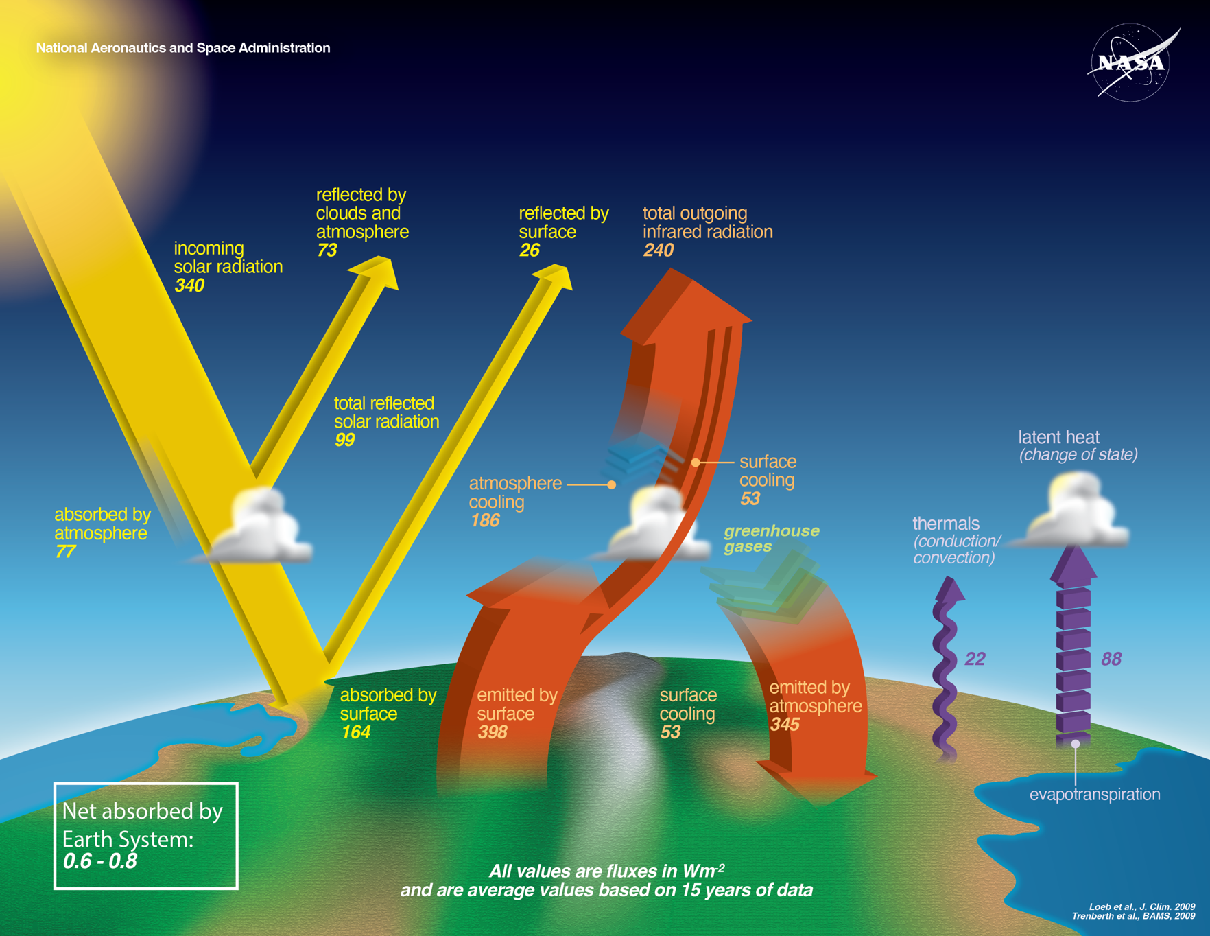
Earth as a System: The GLOBE Program provides students with the ability to explore Earth as a System by examining data sets and exploring protocols related to the Atmosphere, Biosphere, Hydrosphere, and Geosphere (soil, specifically). As they participate in a variety of learning opportunities, students gain insight into the Earth as a System from the local, regional and global perspectives. Through participation in GLOBE, students have the opportunity to contribute to the understanding of how Earth functions as a system through their own data collection and research.
GLOBE Student Research Process
Be a Scientist: The GLOBE Program encourages you to use GLOBE data to help answer questions about how the environment works. Through research projects, you can answer your own science questions by creating hypotheses, analyzing data, drawing conclusions, and sharing your results. Scientific projects that you conduct and that include the use of GLOBE data or protocols can be submitted by your teacher for publication on this GLOBE website. By sharing your findings with the rest of the world you are completing the scientific process.
Steps in the Scientific Process: Science is something you can do. And doing science makes you a scientist! So, what do scientists do? They observe the world around them, ask questions, and use evidence (data) to answer the questions. They identify useful data that already exist or take new measurements. They also do calculations and analyze their data to draw conclusions about the questions they asked. Finally, and most importantly, they communicate their results so everyone can benefit from their work. By doing science, scientists gain a better understanding of the world around them and share that understanding with the whole world. Here are the steps that a scientist takes to conduct a research investigation. By following these steps, you can be a scientist!
Observe Nature: Looking at the world around you is an important first step in scientific research. There are many ways to explore the world and to help identify the area you want to investigate.
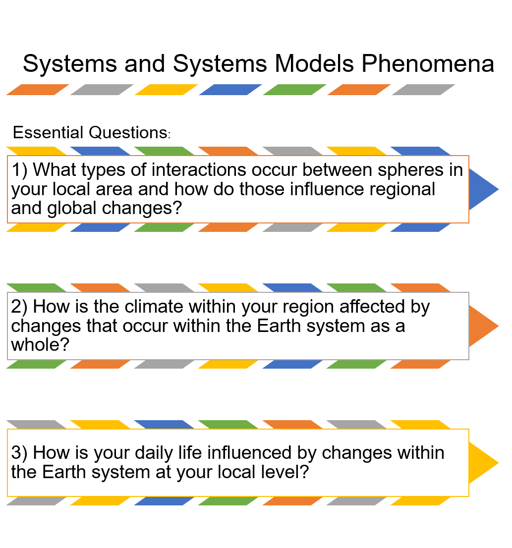
Protocol Bundles
The GLOBE Protocol Bundles focused on an Earth-as-a-system approach to phenomena are linked below. Each GLOBE Protocol Bundle page has a summary of the bundle, a list of the protocols included and additional information. Online e-Training is available for all protocols.
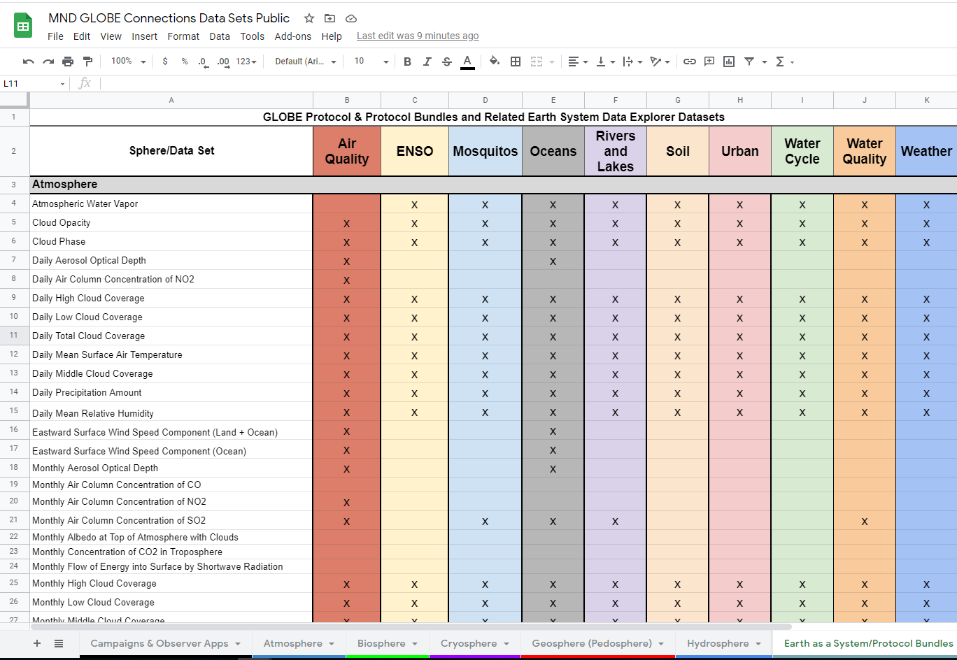
Explore the MND GLOBE Connections Datasets spreadsheet to review the range of datasets available to integrate with GLOBE Protocol Bundle research by visiting the MND GLOBE Connections Data Sets Public link.
Learning Activities
Perceiving Earth as a system begins when we first feel warmth from sunshine or get wet standing in the rain. Understanding Earth as a system requires a quantitative exploration of the connections among all parts (atmosphere, hydrosphere, lithosphere, and biosphere) of the system. The measurements of The GLOBE Program provide students with the means to begin this exploration for themselves. The processes comprising the global environment are interconnected. Many of the major environmental issues of our time have driven scientists to study how these connections operate on a global basis – to understand Earth as a system. Using GLOBE Earth System Learning Activities can guide students in the development of their own personal connections with the different components of the Earth system and how these interact with each other.
Regional Connections-Defining Regional Boundaries (RC1):
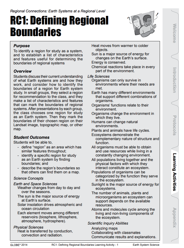 Overview: Students discuss their current understanding of what Earth systems are and how they work, and consider how to identify the boundaries of a region for their Earth system study. In small groups, they select a region for recommendation to the class, and they make a list of characteristics and features that can mark the boundaries of regional systems. After presentations by each group, the class chooses one region for study as an Earth system.
Student Outcomes:
- Define "region" as an area that has similar features throughout
- Identify a specific region for study as an Earth system by finding boundaries
- Describe the region’s boundaries so that others can find them on a map
Regional Connections-Effects of Inputs and Outputs on a Region (RC2):
Overview: Using the region they identified for study in RC1: Defining Regional  Boundaries Learning Activity, or a region identified by the teacher for this activity, students draw an imaginary box around the region. The box includes what is above the Earth’s surface (the atmosphere), and what is below (the soil, or pedosphere). Using their existing knowledge, they discuss and list the inputs and outputs of the region, prompted by guidance questions from the teacher if necessary. Next, students generate and explore “what if” scenarios. (e.g. What if the water flowing into the region were reduced by half? What if it were doubled? What if the land cover upstream were removed, or changed from forest to cropland? What if no birds moved across the region’s boundaries?) Students learn to ask such provocative questions and to make thoughtful predictions of ways in which changing one component might affect the properties of others in the regional system. Prompted by guidance questions, they write about what they have learned.
Student Outcomes:
- Identify some scientifically appropriate inputs and outputs of a system at the regional scale;
- Predict how changes in the input or output of one component of a system might affect other components, reflecting the concept that parts of a system shape each other through their interactions.
Global Connections-Components of the Earth System Working Together (GC2):
Overview: Students review a variety of images and maps of the whole Earth in order to identify the major components of the Earth system at a global scale. The maps show solar energy, average temperature, cloud cover, precipitation, soil moisture, and vegetation, and the images are of the Earth from space. As a class, they discuss some ways that the components of the Earth system interact to form the whole Earth system. They describe the water cycle at the global scale in greater detail, identify the components through which water passes and the processes that move it, and draw an abstract diagram.
Student Outcomes:
- Use images and data about the whole Earth to identify the major components of the Earth system at the global scale and stimulate their thinking about connections among those components
- Describe the pathway of water among the components, as an example of ways they are connected
- Translate their understanding of that pathway into an abstract diagram
A Local Connection-Using Graphs to Show Connections (LC3): ![]()
 Overview: The class explores interconnections among Earth System components by creating graphs of GLOBE student data on air and soils or water temperatures. More advanced students can create graphs with other connected variables, such as precipitation and soil moisture. The class analyzes and interprets these graphs, in response to guiding questions. Each student writes a description of the major interconnections and other variables they have detected in the graphs.
Student Outcomes:
- Analyze and interpret a graph of GLOBE data that shows air and soil or water temperatures over a year;
- Explain how graphs of GLOBE data can show relationships among components of an Earth system.
Overview: Students will try to identify mystery substances in the water.
Student Outcomes:
- Students will learn to use their senses and explain why sometimes you need extra tools to expand your senses.
- Water is a solvent.
- Objects have observable properties.

Sphere(s)
- Earth as a System