GLOBE Connections
GLOBE Protocol Bundle: Air Quality
Air Quality Protocol Bundle
Air quality is a measure of how clean or polluted the air is. Polluted air can be caused by many things. Some causes of air pollution include: emissions from factories, power plants and oil refineries, combustion of oil and gas, smoke from fires, gases and ash from volcanic eruptions, blowing dust, and hydrocarbon emissions by some trees. These causes of air pollution are called primary pollutants because they are emitted directly into the atmosphere from a source (like a car or factory). However, air pollution doesn’t always come directly from a source. Secondary pollutants are caused by chemical reactions in the atmosphere between primary pollutants. This bundle includes several protocols which are related to air quality and will help students with air quality investigations. (Source: GLOBE Air Quality Bundle)
Related Earth System Data Explorer data sets:
Explore the MND GLOBE Connections Datasets spreadsheet to review the range of datasets available to integrate with GLOBE Protocol Bundle research by visiting the link.

Dataset Recommendations and Rationale:
When investigating Air Quality, there are many interrelated variables that can be explored through the Earth System Data Explorer. Some of these are directly related to a GLOBE protocol which is part of the Air Quality protocol bundle. Others are indirectly related. The data sets below have been identified as those that can complement these investigations. The specific GLOBE protocols used in the bundle can be found in the section below the related Earth System Data Explorer data sets section.
These atmospheric chemistry data sets are related to different aspects of air quality.
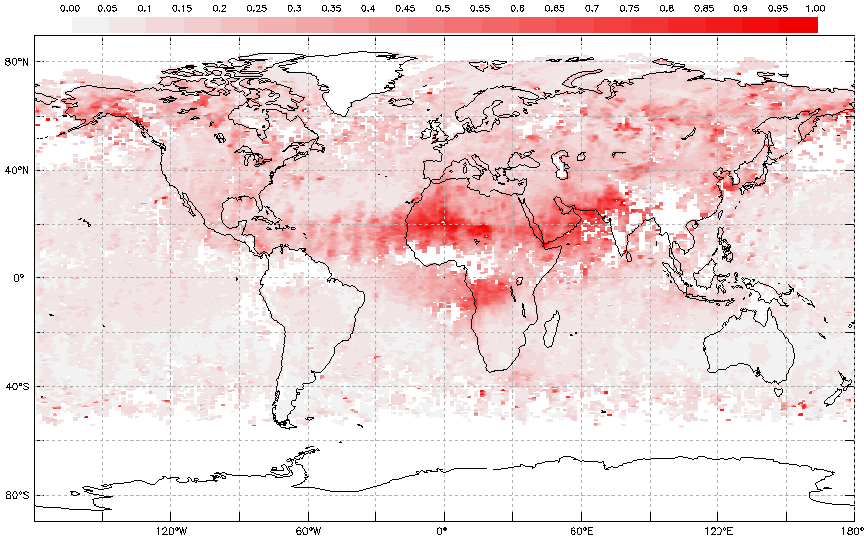
- Monthly Aerosol Optical Depth
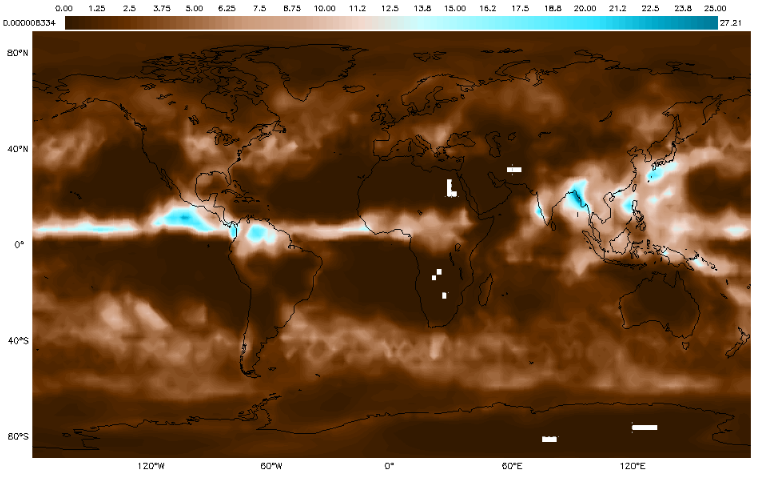
- Monthly Air Column Concentration of CO in the Lower Troposphere
- Monthly Air Column Concentration of NO2
- Monthly Air Column Concentration of SO2

Monthly Aerosol Optical Depth - July 2019
Precipitation data are complemented by cloud, and water vapor data. The relationships between weather and air quality can be explored with these data.
- Daily Precipitation Amount
- Monthly Average Precipitation Rate
- Daily High Cloud Coverage
- Daily Low Cloud Coverage
- Daily Middle Cloud Coverage
- Daily Total Cloud Coverage
- Monthly Low Cloud Coverage
- Monthly Total Cloud Coverage
- Monthly Water Vapor in the Atmosphere
Monthly Precipitation - June 2018
These temperature data sets allow students to explore changes that may be related to ENSO. They can research monthly surface air temperature and air temperature anomalies to help put their own data in context. They can also explore surface temperatures.
- Daily Surface Air Temperature
- Monthly Surface Air Temperature
- Monthly Surface Air Temperature Anomaly
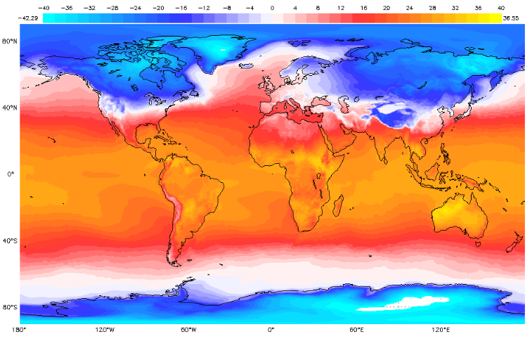
Monthly Surface Air Temperature - February 2019
GLOBE Protocols Included:
- Atmosphere
- Aerosols - Measure aerosol optical thickness using a sun photometer.
- Air Temperature - Measure the current air temperature when an instrument shelter is not available. Current air temperature is measured using a thermometer held in the open air but in the shade for at least 3 minutes.
- Barometric Pressure - Measure barometric pressure using an aneroid barometer.
- Clouds - Observe and report cloud types, cloud cover, opacity, sky color and visibility.
- Precipitation - To determine the amount of moisture input to the local environment by measuring rain and snowfall and to measure the pH of precipitation.
- Relative Humidity - Measure relative humidity using either a digital hygrometer or a sling psychrometer.
- Biosphere
- Land Cover Classification - Locate, photograph and classify using the MUC class for a 90 meter by 90 meter homogenous area.