Volcanic Eruptions

Background
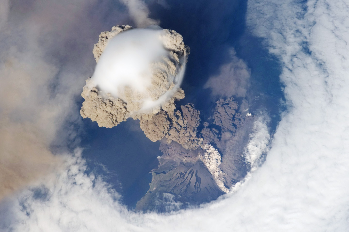
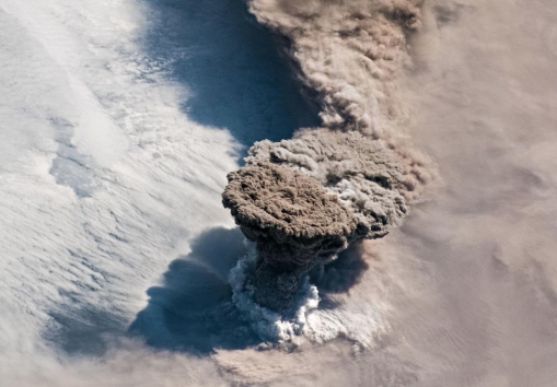
Volcanoes are windows into the interior of the Earth. Through subtle changes and dramatic explosions, they intrigue scientists and often strike fear into societies. Lava flows, pyroclastic flows, and lahars pose great risk to those living in the proximity of a volcano, while large explosive eruptions can affect the entire planet by filling the atmosphere with ash and sulfate particles thereby modify the global climate.
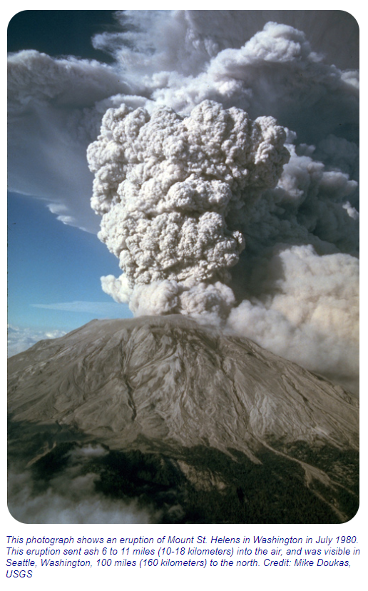
Explosive volcanic eruptions pose both short-term and long-term hazards. Lava flows and lahars can wipe out the flanks of mountainsides. Volcanic ash can blanket the landscape for miles, and ash clouds can disrupt aircraft travel, such as the incident in 1989 when ash from Alaska's Redoubt volcano temporarily disabled a passenger airplane. On longer time scales, eruptions can inject massive quantities of ash into the atmosphere, greatly reducing the solar heating of the Earth and potentially interrupting the global food supply for several years.
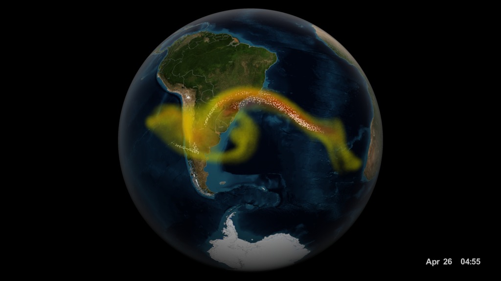
In 1991, Mount Pinatubo in the Philippines erupted, and strong winds spread the aerosol particles from the plume around the globe. The result was a measurable cooling of the Earth's surface for a period of almost two years. The role of natural hazards research and developing applications to mitigate the effects of disasters has global implications for reducing loss and saving lives.
The eruptive power and often long intervals of quiet dormancy of volcanoes make them both difficult to study, and difficult to live near. The threat of eruption is always there, but because eruptions are temporally episodic and occur distributed around the globe, we must rely on methods that give us observations of volcanic activity globally.
Evans, Diane, et al. “Solid Earth Science Working Group (SESWG).” NASA, NASA, 5 Feb. 2013, solidearth.jpl.nasa.gov/PAGES/volc01.html.
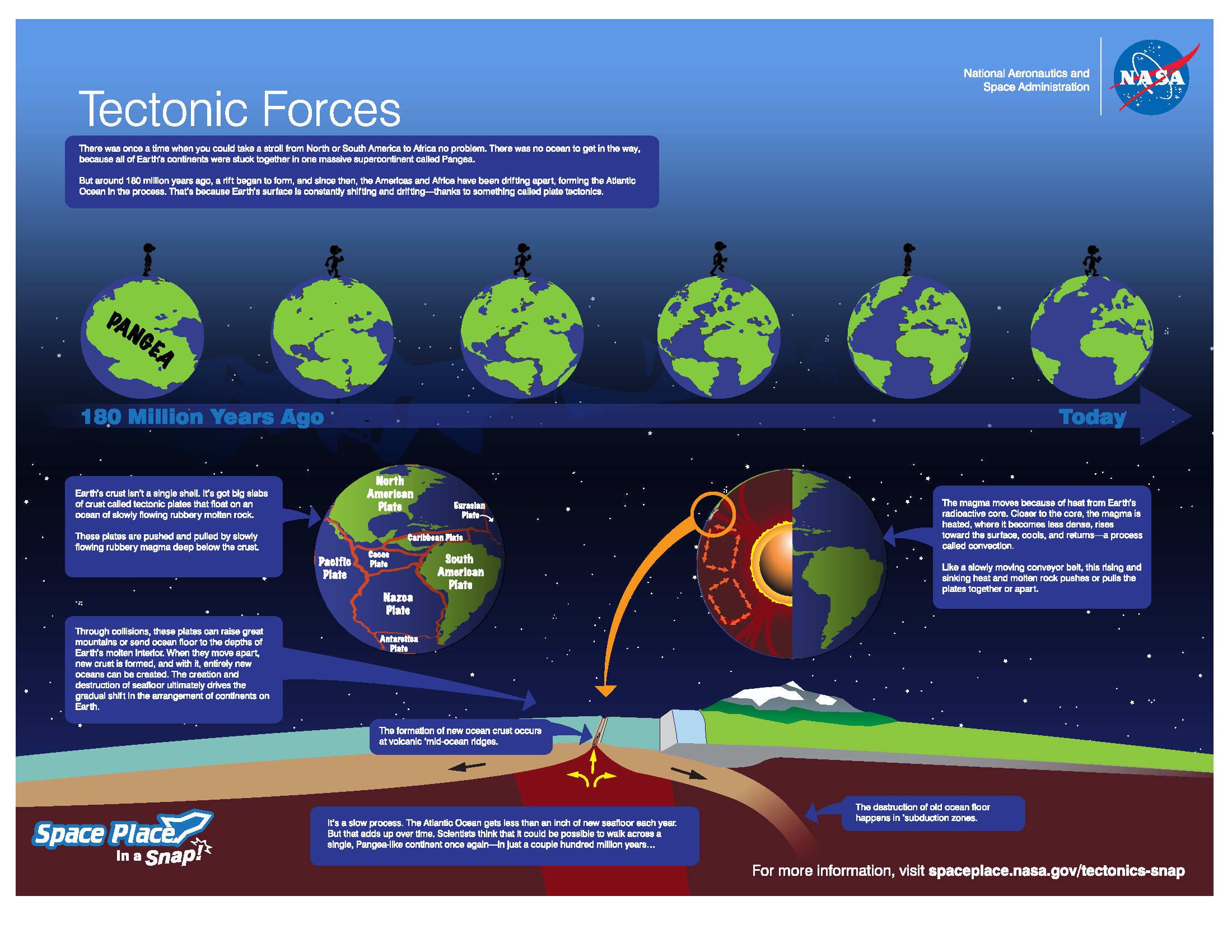
Plate Tectonics
The forces behind volcanoes were long a mystery. However, scientists eventually began to understand the geologic forces behind the formation of volcanoes. The video Tectonic Forces is a brief introduction to plate tectonics and the forces which drive volcanoes.
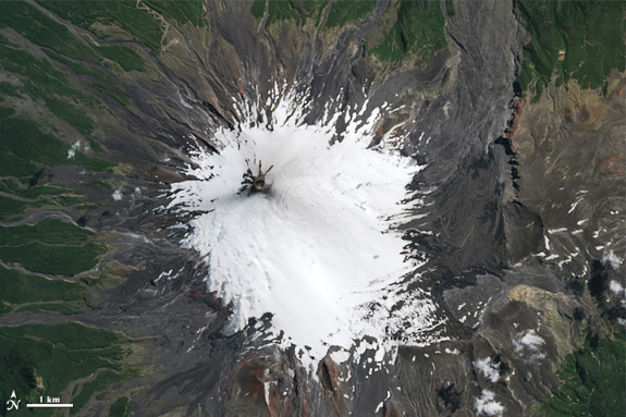
The Smithsonian National Museum of Natural History Global Volcanism Program maintains a database of the volcanoes on Earth. This Eruptions, Earthquakes and Emissions visualization shows the history of volcanic and earthquake activity from 1960 through 2016. The tectonic plate boundaries become evident from the data when you look at the visualization. The convergent boundaries along the Pacific Ring of Fire clearly show up in as well as the mid-Atlantic ocean ridge divergent boundary. In addition, you can see Hawaii (a shield volcano), which is located at a hot spot.
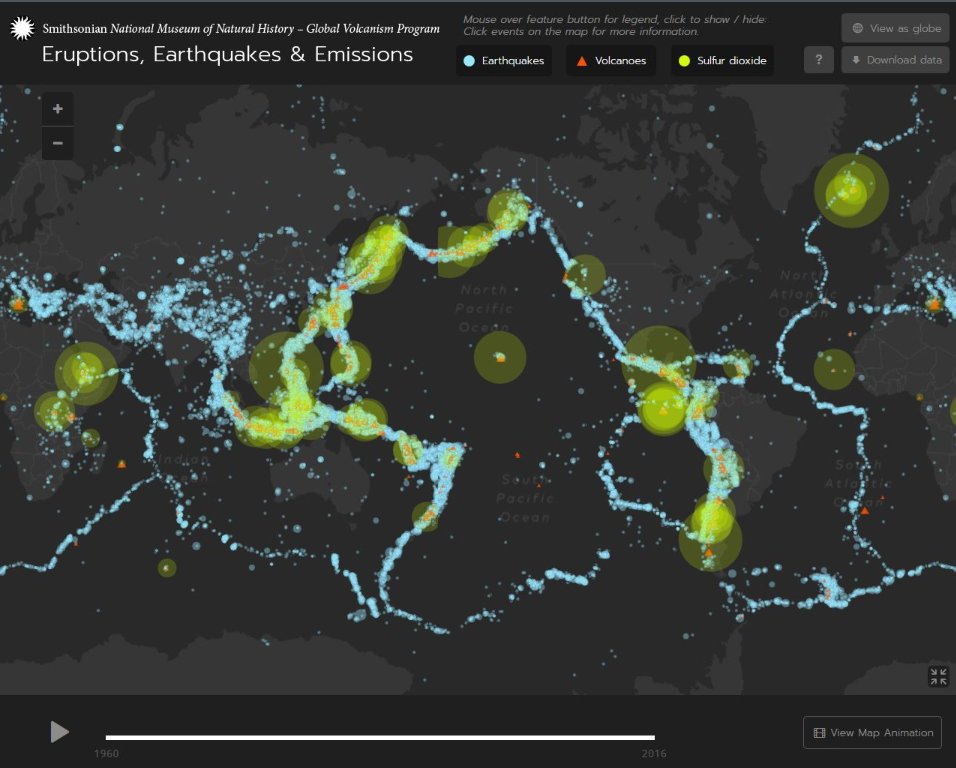
In addition to volcanoes, the visualization shows earthquakes. This is because earthquakes also occur at tectonic plate boundaries. Explore the relationship between volcanoes and earthquakes in this Smithsonian video: Plate Tectonics.
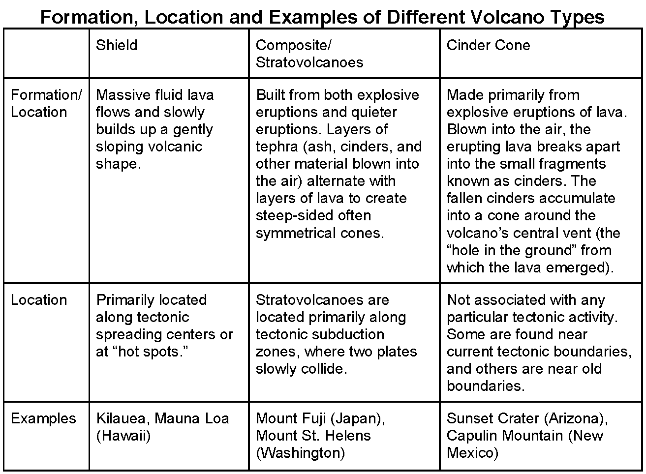
Types of Volcanoes
There are three major types of volcanoes that form differently. The chart below describes how and where they form, where they are located, and gives examples of each type.
How do Volcanoes Erupt?
How and Why does NASA Study Volcanoes?
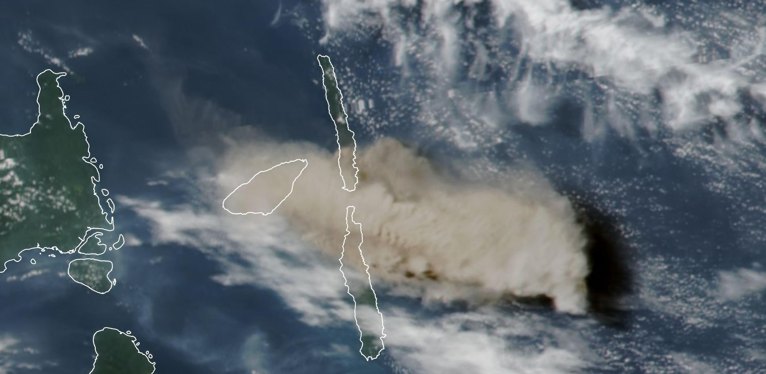
More than 1,500 potentially active volcanoes dot the Earth’s landscape, of which approximately 500 are active at any given time. Although scientists keep watch over many of the Earth’s volcanoes using traditional ground observation methods, satellite-based remote sensing is quickly becoming a crucial tool for understanding where, when, and why the Earth’s volcanoes periodically boil over.
Satellite technology now makes it possible to monitor volcanic activity in even the most isolated corners of the globe and to routinely observe changes in the Earth’s surface that may signal an impending eruption. In addition, remote sensing data offer scientists the chance to prevent catastrophic damage to life and property by determining how and where volcanic debris spreads after an eruption.
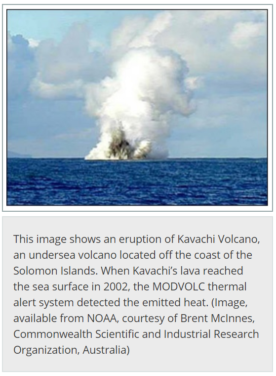
The MODIS Thermal Alert System, known as MODVOLC, now enables scientists to detect volcanic activity anywhere in the world within hours of its occurrence. MODVOLC uses data acquired by the Moderate Resolution Imaging Spectroradiometer (MODIS) sensors, which fly aboard NASA’s Terra and Aqua satellites. “The algorithm we’ve developed scans each 1-kilometer pixel within every MODIS image to see if it contains high-temperature heat sources, or hot spots. These heat sources may be active lava flows, lava domes, or lava lakes. Since MODIS achieves complete global coverage every 48 hours, this means that our system checks every square kilometer of the globe for volcanic activity once every two days,” said Dr. Robert Wright [research scientist at the Hawaii Institute of Geophysics and Planetology (HIGP)].
For each hot spot identified, MODVOLC records the date and time at which it was observed, its geographic coordinates, the position of the satellite and the Sun, and the spectral radiance (the amount of energy emitted by the Earth’s surface at various wavelengths in the electromagnetic spectrum). Since active lava flows or growing lava domes emit vast amounts of energy, these hot spots are relatively easy to detect in MODIS imagery, even when they are smaller than MODIS’ 1-kilometer resolution.
According to Dr. Peter Mouginis-Mark [research scientist at HIGP], perhaps the greatest benefit offered by satellite-monitoring technology will be an enhanced understanding of exactly how volcanoes work. “What’s important is the global perspective and the way volcanoes work on different timescales,” he said. “Some volcanoes produce lava flows, and other volcanoes explode so that you have to worry about big eruption columns. We now have this remote capability to study volcanoes anywhere in the world.”
Although scientists will continue to use ground monitoring techniques to keep an eye on the Earth’s volcanoes, satellite data will increasingly allow scientists to see “the big picture” and, as a result, better predict volcanic activity.
“Satellite data are brilliant for understanding the levels of eruption intensity and for monitoring the impact an eruption is having on the surrounding environment,” said Dr. Mouginis-Mark. “The ability to draw on ASTER or MODIS data and put together a one- to three-year sequence of observations really lets us look at whether there are real changes going on in a volcano.”
“Compiling a global database of volcanic thermal unrest has allowed us to look at long-term trends,” said Dr. Wright. “We’re currently analyzing the entire MODVOLC data set to identify patterns that help us better understand how all the Earth’s volcanoes behave.”
Schmidt, Laurie J. “Sensing Remote Volcanoes | Earthdata.” NASA, NASA, 14 May 2019.
Volcanoes and the Earth System
Geographers conceptualize Earth in terms of physical systems (the lithosphere, the biosphere, the hydrosphere, and the atmosphere) and human systems that are unified in a single, highly interconnected system. Changes in one system lead to changes in other systems, with an impact on a variety of scales, from local to regional to global. Volcanoes provide an outstanding opportunity to highlight the relationships between human and physical systems and how humans deal with natural hazards.
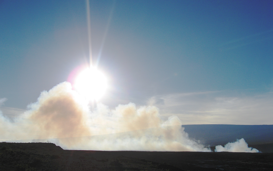
Volcanoes are dangerous, but they are also very important to humans. Volcanic eruptions contribute substantially to soil fertility. In the Andes, many people live on the flanks or at the foot of active composite volcanoes, largely because of the fertility of the volcanic deposits. The same is true in the Philippines where residents near active volcanoes like Mount Mayon and Mount Taal regularly move away during eruptions, only to move right back when the danger subsides. These two cases present good examples of how people learn to live and adapt to hazardous environments.
“How Close Is Safe: Buffer Zone Development.” NASA, NASA, https://science.nasa.gov/how-close-safe-buffer-zone-development.
Sources:
- Evans, Diane, et al. “Solid Earth Science Working Group (SESWG).” NASA, NASA, 5 Feb. 2013.
- “Tectonic Forces.” NASA Space Place, NASA
- “How Close Is Safe: Buffer Zone Development.” NASA, NASA.
- Smithsonian's National Museum of Natural History. “Plate Tectonics.” Plate Tectonics, Smithsonian Institution Global Volcanism Program, 20 Jan. 2012.
- Smithsonian's National Museum of Natural History. “Volcanoes Under Pressure.” Volcanoes Under Pressure, Smithsonian Institution Global Volcanism Program, 23 Jan. 2012.
- Schmidt, Laurie J. “Sensing Remote Volcanoes | Earthdata.” NASA, NASA, 14 May 2019.