Global Phytoplankton Distribution Story Map
loading Biosphere...
Featured Lesson Plans
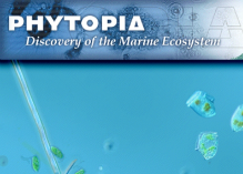
In this lesson, students investigate and identify various phytoplankton using images that were previously taken with a compound microscope. Credit: This lesson is modified from a lesson of the same name created by The Center for Microbial Oceanography: Research and Education (C-MORE)
In this activity, you will use an inexpensive spectrophotometer* to test how light at different visible wavelengths (blue, green, red) is transmitted, or absorbed, through four different colored water samples.
This lesson is taken from NASA's Phytopia: Discovery of the Marine Ecosystem written in partnership with Bigelow Laboratory for Ocean Science with funding from the National Science Foundation.
Students use Phytopia: Exploration of the Marine Ecosystem, a computer-based tool, to investigate various phytoplankton species and topics relating to phytoplankton biology.
These six graphs show Ocean Chlorophyll Concentrations from 1998 - 2018 in a variety of locations: East Bering Sea, Gulf of Alaska, California Coast, Southeastern US/Gulf of Mexico, Northeastern US and the Scotian Shelf, and the Hawaiian Islands.