Mini Lesson/Activity
Stability and Change: Changes in Sea Ice
Overview
This mini lesson helps students visualize how the Hydrosphere and Cryosphere interact to produce changes in land and sea ice.
Student Directions
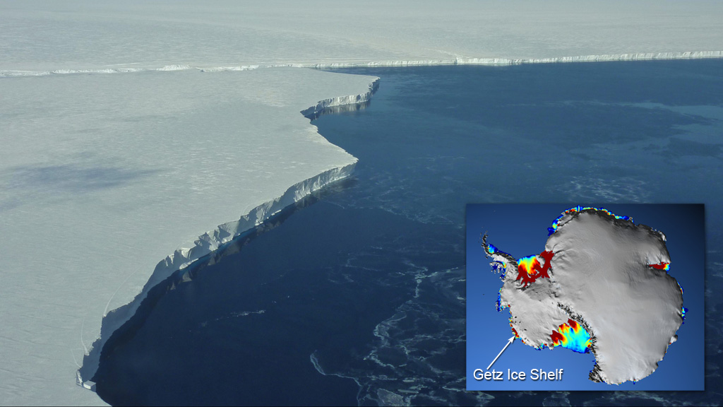
Dynamic changes sometimes occur at the interface where the Cryosphere and Hydrosphere interact. This is true for Western Antarctica where NASA Scientists are monitoring change of the ice shelf thickness. Ice shelves are permanent floating sheets of ice that connect to landmasses like Antarctica. Warm ocean currents have spurred the rapid thinning of the Pine Island Glacier and Getz ice shelves in Antarctica as shown below.
Credit: NASA's Goddard Space Flight Center
https://mynasadata.larc.nasa.gov/sites/default/files/inline-images/GetzIceShelf_1024x576.jpg
Steps
-
Observe the photo showing the interface of the Western Antarctica ice shelves and the Amundsen Sea. The ice shelves are indicated by the rainbow color; red is thicker (>550m), while blue is thinner (<200m).
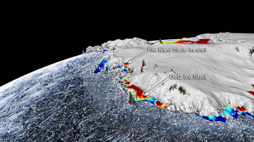
Warm ocean currents have spurred the rapid thinning of the Pine Island Glacier and Getz ice shelves.
Credit: NASA's Goddard Space Flight Center
https://mynasadata.larc.nasa.gov/sites/default/files/inline-images/GetzAndPIG_2_1024x576.jpg - Now review the visualization Currents of Change (2012) and answer the questions below. Check with your instructor on how to submit your answers.
- What color do you see the most of along the edges of the ice shelves?
- What do these data mean about the thickness of the ice in these locations?
- What factors may contribute to this phenomenon?
Sources:
- Currents of Change. (2012, May 3). NASA's Goddard Space Flight Center. NASA Visualization Studio. Retrieved June 22, 2022, from https://svs.gsfc.nasa.gov/10970
Teacher Note
Teachers, these mini lessons/student activities are perfect "warm up" tasks that can be used as a hook, bell ringer, exit slip, etc. They take less than a class period to complete. Learn more on the "My NASA Data What are Mini Lessons?" page.
Teachers who are interested in receiving the answer key, please complete the Teacher Key Request and Verification Form. We verify that requestors are teachers prior to sending access to the answer keys as we’ve had many students try to pass as teachers to gain access.
Disciplinary Core Ideas:
- ESS2A: Earth Materials and Systems
Crosscutting Concepts:
- Cause and Effect
- Stability and Change
Science and Engineering Practices:
- Developing and Using Models
- Analyzing and Interpreting Data
- Constructing Explanations and Designing Solutions

