Lesson Plans
Glacial Retreat: Quantifying Changes in Glacier Cover Over Time
Overview
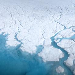
In this activity, students use satellite images from the NASA Landsat team to quantify changes in glacier cover over time from 1986 to 2018. This lesson utilizes change pair images of Bear Glacier in Kenai Fjords National Park, located on the southeastern portion of Alaska’s Kenai (pronounced: Key-nigh) Peninsula, bordering the Gulf of Alaska.
Materials Required
The following materials are available to download and print:
- Glacier Retreat worksheet for each student (Student Data Sheets)
- Cover Change Grid for each pair of students - You will need to transfer the ready-made grid to a transparency sheet. (Found in Student Data Sheets)
- NASA Landsat images for each pair of students showing Bear Glacier in 1986, 2002, and 2018 (Bear Glacier Images)
The following materials are also needed:
- Transparency sheets
- Markers of different colors with fine points for writing on transparencies
We highly suggest that the NASA Landsat Images of Bear Glacier be printed out in color and laminated. Color images facilitate the differentiation of glacier cover from land cover, and laminating the satellite images allows them to be used more than once.
Procedure
- Together with your partner, visually identify the areas in each image that are covered by Bear Glacier.
- Be careful not to include the icebergs floating in the lake or snow that has collected in the mountains that is not part of the glacier itself.
- Place the transparency with the cover change grid over the image from 1986, and tape the corners of the transparency to the image.
- One partner will hold the image while the other partner outlines the glacier cover on to the transparency with a colored marker.
- Make a legend for your transparency cover change grid, which is now becoming a glacier cover map.
- Place the transparent glacier cover map you just made over the 2002 image of Bear Glacier and tape the corners to hold it in place.
- Using a different color of marker than you used in Step 3, trace the outline of the 2002 glacier on the transparency grid.
- Count and record the number of grid squares representing a change in glacier cover. It will take both partners to do this:
- One partner will compare the transparency map to the 2002 satellite image and identify the grid squares that show glacier change. You may notice that some squares contain land that is only partially covered by the glacier. In this case, the most dominant cover type should be used.
- The other partner will mark the equivalent changed squares using the Cover Change Grid. Work from the upper left to the upper right across each row, putting a dot in each square that represents a change in glacier cover.
- Repeat Steps 3-6 using the 2018 Landsat 8 image.
- Once you have determined how many grid squares represent a change in glacier cover, you will use this information to calculate the percent cover change in the satellite images provided of Bear Glacier.
- Your teacher will ask for everyone’s results and then list them on the board. Write them down and then use them to calculate the class average.
Disciplinary Core Ideas:
- ESS2A: Earth Materials and Systems
- ESS2C: The Role of Water in Earth’s Surface Processes
- ESS2D: Weather and Climate
- ESS3D: Global Climate Change
Crosscutting Concepts:
- Cause and Effect
- Scale, Proportion, and Quantity
- Stability and Change
Science and Engineering Practices:
- Asking Questions and Defining Problems
- Developing and Using Models
- Planning and Carrying out Investigations
- Analyzing and Interpreting Data
- Using Mathematics and Computational Thinking
- Engaging in Argument from Evidence
- Obtaining, Evaluating and Communicating Information
- To analyze changes in glacier cover over time using satellite images.
- How does Earth's cryosphere change over time?
- How can we measure cryospheric changes?
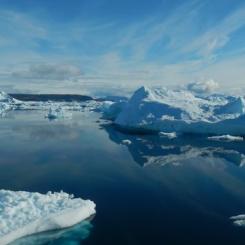
Along the coastline of the park, glaciers have cut deep valleys into the mounta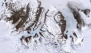 ins. As the glaciers retreat, these coastal valleys are filled with seawater, creating fjords. Changes in precipitation have caused Bear Glacier to recede. As glaciers recede, they leave behind rock and debris, which is called a moraine. Bear Glacier, as it retreated, paused long enough to build up a sizeable moraine. In fact, the beach in front of Bear Glacier is an old recessional moraine that has cut off Bear Glacier’s access to the tidewater’s edge. As a result, Bear Glacier, once classified as a tidewater glacier, is now a terrestrial glacier.
Glaciers are retreating not only along Kenai Fjord’s coast but all throughout the park. In fact, most of Alaska’s estimated 10,600 glaciers are melting. Monitoring the glaciers can help determine why they are retreating. Glacier-monitoring efforts in national parks provide valuable information to park managers, as well as to the scientific community at large, about the effects of regional and global climate change. However, direct observations of glaciers are often difficult because they exist in cold, polar regions or high mountain areas that are inaccessible or inhospitable to humans. Furthermore, ice sheets and ice caps are so huge and change so slowly that repeated measurements are needed over large areas and long periods of time. Until recently, glaciologists had no accurate means of seeing the aerial extent of glacier ice on Earth.
![]() Teachers: This is a NSTA-vetted resource. Read the NSTA review of this lesson for ideas on how to adapt it for fuller NGSS alignment.
Teachers: This is a NSTA-vetted resource. Read the NSTA review of this lesson for ideas on how to adapt it for fuller NGSS alignment.
Students will need to know how to calculate percent of a total.
The following selected text is taken from AntarcticGlaciers.org: Common misconceptions about glaciers.
Glaciers that are neither advancing nor receding are stationary
The snout (or terminus) of a glacier may be stationary, but the ice itself isn’t. The terminus of a glacier is stationary when accumulation (snow) at the top of the glacier is equal to ablation (melt) at the bottom of the glacier. Since the top of the glacier is not getting thicker and thicker and the bottom of the glacier is not disappearing, there is transfer of mass from the top of the glacier to the bottom. When a glacier is in equilibrium like this, it still flows downslope under the force of gravity.
If accumulation at the top of the glacier is greater than ablation at the bottom, the glacier will advance, and possibly accelerate. If ablation (melting) is greater than accumulation, then the glacier will shrink. If accumulation = ablation, then the glacier’s mass balance is in equilibrium.
Retreating Glaciers flow backwards
A glacier is a pile of ice, and will always flow downwards under gravity. If more ice melts at the snout than is replenished at the top by snowfall, then the glacier will recede, or shrink – it will still flow downwards, but the snout position moves back. I tend to avoid using ‘retreat’ as it has these connotations of ice flowing backwards. If in doubt, remember that armies retreat (turn around and run away), but hairlines recede (the hair keeps growing, but falls out at the front).
Glaciers aren't important
The polar ice caps regulate our global ocean circulation, so large ice sheets play a vital role in our climate. Small glaciers around the world are melting, and contributing to sea level rise. Ice shelves around Antarctica play an important role in regulating rates of ice flow.
Glaciers move slowly
In fact, glaciers flow at a variety of speeds, which is controlled by a number of factors, but primarily their thermal regime. They may be wet-based or cold and dry-based, depending on the temperature of the ice, basal roughness and how thick the glacier is. Simetimes you can get cooling glaciers under a warming climate – increased melting results in thinning, and the glacier is no longer thick enough for the ice to melt at its base. The glacier is ‘cold’ – it is dry at its base, and therefore moves very slowly and is not effective at sediment erosion or transportation.
However, some glaciers on steep slopes in temperate regions can flow very fast indeed. Fox Glacier, in New Zealand, is one of the fastest-flowing valley glaciers in the world. Fox Glacier can flow at up to 5 meters per day.
Satellite images provide scientists aerial views of glaciers, and a major source of these images has been provided by the Landsat Program. The Landsat Program is a series of Earth-observing satellite missions jointly managed by NASA and the U.S. Geological Survey. Since 1972, Landsat satellites have collected information about Earth from space by taking specialized digital photographs of Earth’s continents and surrounding coastal regions. The Landsat program enables people to see and study the dynamic changes caused by both natural processes and human practices.
One way to evaluate these changes is to compare images of a single area over an extended period of time. Two satellite images taken at different times of the same location are called "change pairs" and are frequently used by glaciologists to evaluate changes in a glacier. This lesson features three images to compare change over time.
Glaciologist - Glaciology is the study of snow and ice. A glaciologist is one who studies and analyzes the movement and physical properties of glaciers and ice. Glaciologists research characteristics of the Cryosphere that include formation, movement, and effects of other parts of the Earth System. A characteristic of their research is to analyze how glaciers and ice caps move and change due to climate change and how those changes influence the climate and surrounding environment.
- One-to-One (tablet, laptop, or CPU)