STEM Career Connections
TECHNOLOGY: LIDAR Remote Sensing

Work Description
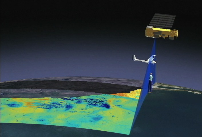
LIDAR Remote Sensing Technologists uses remote sensing strategies to analyze data to solve problems in areas across the globe. They use LIDAR - Light Detection and Ranging - as a method of remote sensing to examine the surface of the Earth.
Why is this job Important?
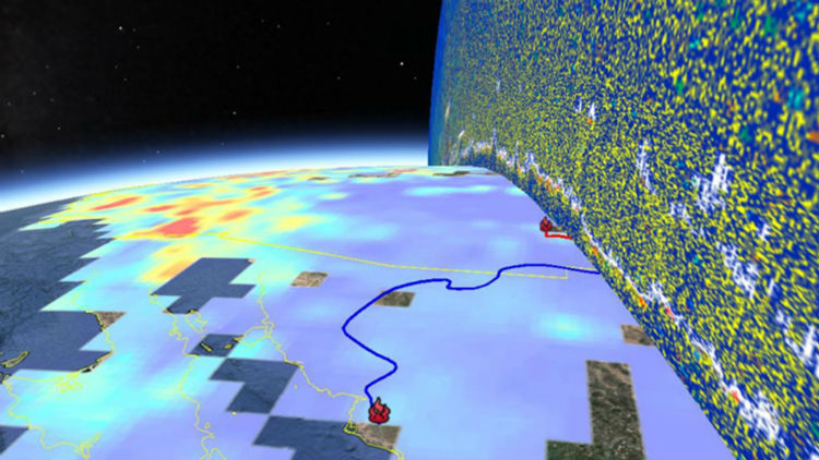
Lidar is an important tool used by scientists and researchers to be able to map images of the Earth collected from instruments fitted on aircraft and satellites. It is a method that measures the distance to a target by sending the pulsed laser light to the target and measuring the reflected pulses with a sensor. Differences in the return times and wavelengths of the laser are used to make digital maps of the target.
Education
Remote sensing scientist requires a minimum of a bachelor’s degree in geography, cartography, civil engineering, or related fields.
Related Fields
NASA Connections
Job Title NASA Examples:
- Geographic Information System (GIS) Scientist
- Geographers
- Geoscientists
- Operations Research
- GIS Technicians
NASA Career Links: