Interactive Models
Space Weather Maps
Overview
In this interactive you will create space weather forecast maps for solar minimum and solar maximum.
Materials Required
Directions
Remember to never look directly at the Sun without proper safety equipment.
- Read the background information on space weather on slides 3-6.
- Read the forecast for solar minimum on slide 7.
- Complete the interactive space weather forecast map for solar minimum on slide 8.
- Read the forecast for solar maximum on slide 9.
- Complete the interactive space weather forecast map for solar maximum on slide 10.
- Share your maps as direction by your instructor.
Teacher Note
Teachers who are interested in receiving the answer key, please complete the Teacher Key Request and Verification Form. We verify that requestors are teachers prior to sending access to the answer keys as we’ve had many students try to pass as teachers to gain access.

Disciplinary Core Ideas:
- PS2B: Types of Interactions
- PS4A: Wave Properties
- PS4B: Electromagnetic Radiation
- ESS1A: The Universe and its Stars
Crosscutting Concepts:
- Patterns
- Cause and Effect
- Structure and Function
Science and Engineering Practices:
- Developing and Using Models
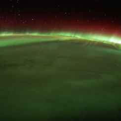
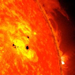
- Students will be able to identify key components of space weather (solar cycle, sunspots, geomagnetic storms, aurora).
- Students will be able to use space weather data to create a space weather map.
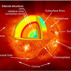
- What is space weather?
- How do scientists predict space weather?
- How do space weather effects vary throughout the solar cycle?
- Internet Required
- One-to-One (tablet, laptop, or CPU)
- One-to-a-Group
- Teacher computer/projector only
Complementary Interactives
Complementary Mini Lessons

Interactive Files
Grade Band
- 6-8
- 9-12
Time
- 30 minutes
Visualization Tool
NGSS Three Dimensional Learning
- See drop-down menu at the bottom of the page