Lesson Plans
Hurricane Dynamics: Maps, Graphs, and Data
Overview
This Lesson Plan provides maps, graphs, and data tables for use with the Data Literacy Cubes. Because it is a differentiated resource, it is appropriate for multiple grade bands.
Materials Required
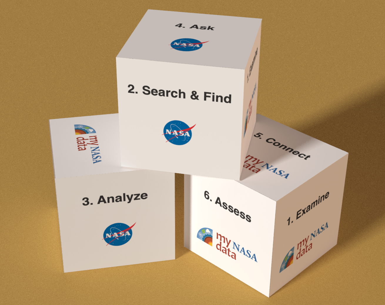
Refer to the Data Literacy Cube Guide for the cube template, questions sheets, question forms and optional team task roles.
- Cube template
- Selected question sheets for Google Forms
- 1 sheet of paper per student
- Pencil
- Graph (as a handout or projected on the screen)
Teacher Preparation:
- Print copies of the cube on cardstock and cut out.
- Assemble the cube with glue.
- Consider laminating after you cut these out for multiple uses.
- Gaming dice may be substituted for the cubes.
- Also, print off copies of the differentiated Graph Cube Questions if you are not using the Google Forms.
- Distribute to students for group or independent work.
Procedure
Steps:
- Distribute your Earth science Map, Graph, or Dataset to the group or groups of students as well as provide the data cube (or regular die).
- Distribute the appropriate-leveled question sheets to each group or use the Google Forms.
- Optional: Assign each student a role from the task card for each group.
- Instruct the students to roll the cube once.
- Answer one question found under the matching question on the Question Sheet. (If more room is needed, have students use a sheet of paper, labeling the question with the number and letter of the question.)
- Repeat Steps 2 thru 4 until at least 4-6 are answered.
- Have each group share their findings with another group (or with the class) after completing their question sheet.
- Monitor student progress and assign new level sets as students reuse the cubes throughout the year.
For more information about how to use the Data Literacy Cubes, visit our YouTube page and watch the Data Literacy Cubes playlist tutorials.
- Familiarity with finding coordinates on a map
National Geography Standards
- How to use maps and other geographic representations, tools, and technologies to acquire, process, and report information from a spatial perspective.
- Standalone Lesson (no technology required)
- One-to-One (tablet, laptop, or CPU)
- One-to-a-Group
- Teacher computer/projector only
Complementary Lesson Plans
-
Grade Level: 6-8, 9-12
Tropical Cyclone Counts - Compare Data Displays

-
Grade Level: 3-5, 6-8, 9-12
Hurricane Katrina A Problem-Based Learning Module


Teacher Resources
Grade Band
- 3-5
- 6-8
- 9-12
Time
- 30 minutes