Lesson Plans
Blue Marble Matches: Using Earth for Planetary Comparisons
Overview
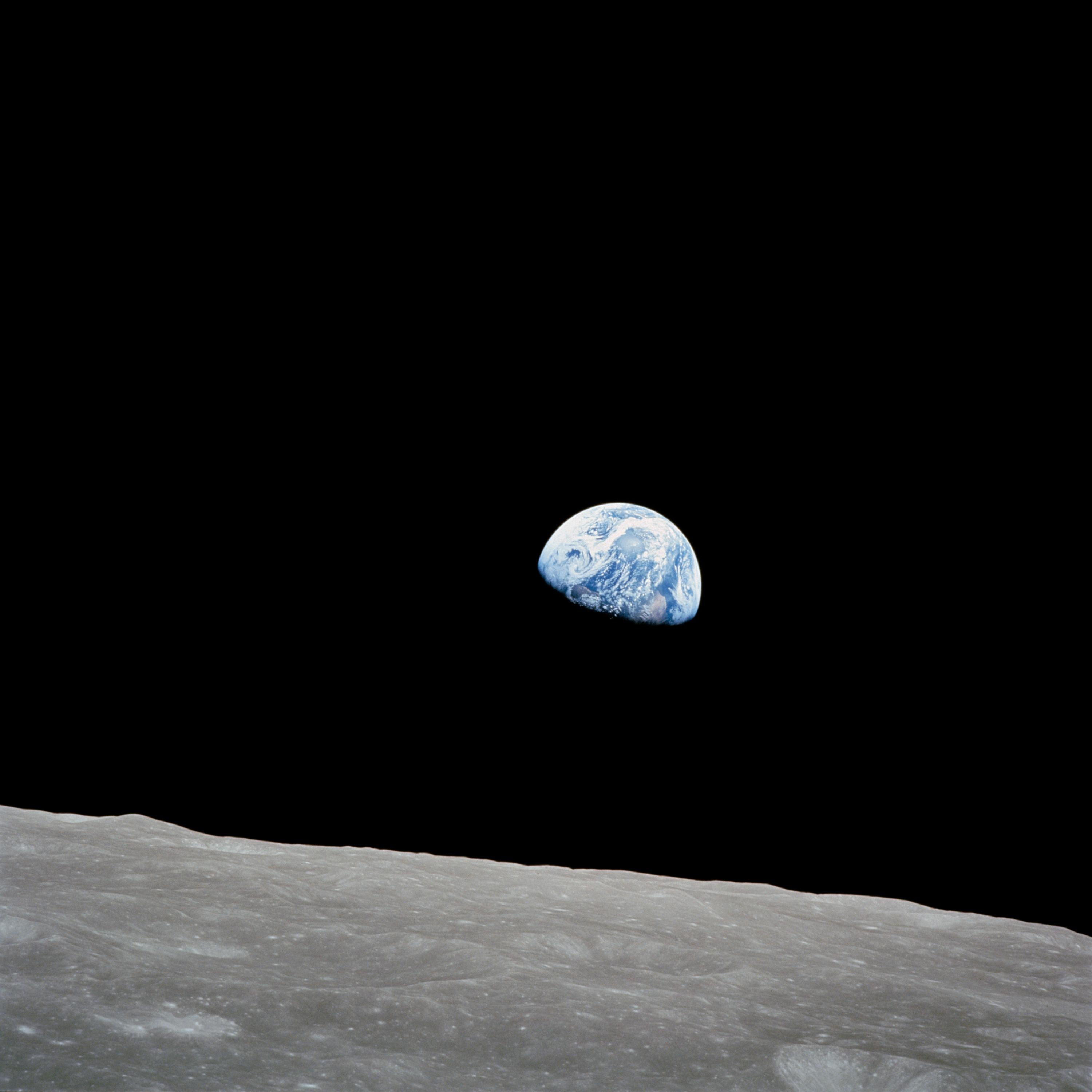
This activity is designed to introduce students to geologic processes on Earth and how to identify geologic features in images. It will also introduce students to how scientists use Earth to gain a better understanding of other planetary bodies in the solar system.
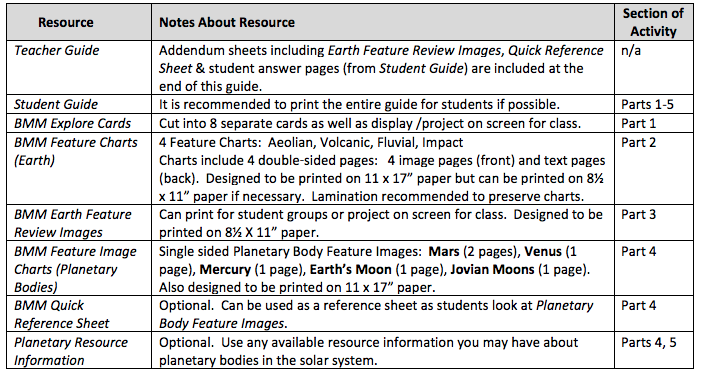
Blue Marble Matches includes a teacher guide, student guide, Explore Cards, BMM Feature Charts for Earth, Earth Feature Review Images, Feature Image Charts for Planetary Bodies, optional Quick Reference Sheet, and optional Planetary Resource Information.
Materials Required
Procedure
To access the Activity Procedure for each part of the activity, please visit this link.
https://www.nasa.gov/pdf/565431main_BlueMarbleMatches_Guide.pdf
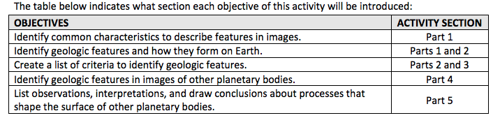
Students will:
1. Identify common characteristics to describe features in images.
2. Identify geologic features and how they form on Earth.
3. Create a list of criteria to identify geologic features.
4. Identify geologic features in images of other planetary bodies.
5. List observations, interpretations, and draw conclusions about processes that shape the surface of other planetary bodies.
How can Earth help scientists better understand what happens on other planets in the solar system?
This activity is designed to introduce students to geologic processes on Earth and how to identify geologic features in images. It connects the shape of the Earth’s surface (and the names of the features that correspond to those shapes and textures) to the processes that form them. Students should work to gain an understanding of how the processes work as opposed to just remembering the names of features. For younger students, this may be somewhat challenging and require higher order thinking skills. Understanding the processes that create the features is an extremely important concept. This activity will also introduce students to how scientists use Earth to gain a better understanding of other planetary bodies in the solar system.
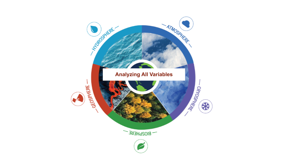
Scientists who study Earth oftentimes study it using an Earth Systems Science approach. This approach looks at Earth being made up of different parts (systems) that work together to make up the planet as a whole. The following 4 “spheres” is one way to break down Earth’s systems: 1) Atmosphere: mixture of gases and small particles above the surface and surrounding the planet; 2) Biosphere: related to living systems (life); 3) Hydrosphere: water in solid and liquid states; and 4) Lithosphere (sometimes referred to as the Geosphere): rocks, soils, and sediment. These different Earth systems are all connected and combined make up our unique planet (see Figure 1 on page four of the Student Guide). Other terrestrial (rocky) bodies in our solar system (the Moon, Mars, Venus, etc.) have a lithosphere ‐‐ they have rocks ‐‐ but they may not have any of these other systems that make up Earth. For example, some also have atmospheres, others do not. No other planetary body in our solar system has a biosphere that we know of…yet. This activity will focus on geologic features which are a part of the litho/geosphere. Although the systems approach to studying other planetary bodies is not the focus of this activity, an introduction to the importance of the interaction of different systems on Earth is important. The interaction of different systems on other planetary bodies will play a role in the past, present, and future of these bodies, just as they do on Earth.
Useful Websites for Additional Background Knowledge:
- Gateway to Astronaut Photography: http://eol.jsc.nasa.gov
- Planetary Photojournal: http://photojournal.jpl.nasa.gov
- NASA Science: http://nasascience.nasa.gov/
- NASA Home Page: http://www.nasa.gov
- Google Earth: http://earth.google.com/
- NASA Earth Observatory: http://earthobservatory.nasa.gov
- NASA Career Resources: http://www.nasa.gov/about/career/index.html
- People involved in Solar System Exploration: http://solarsystem.nasa.gov/people/index.cfm
- Exploring the Planets: http://www.nasm.si.edu/etp/
Teacher Note: The Blue Marble Matches Student Guide is designed to include activity sheets and text to allow students to rely less on the teacher for information and instruction, and more on themselves as independent learners. You are encouraged to review information with students to ensure understanding of concepts and instructions.
Scientists use information about Earth's geologic processes to draw conclusions about the surfaces of other planets. This lesson helps students understand how they can compare planets using Earth as a standard. It introduces students to aspects of the atmosphere, biosphere, hydrosphere, and litho/geosphere and how they are interrelated. By the end of the activity, students will be able to identify common geologic features, discuss how those features form and use observations to form conclusions about what processes helped shape the surface of other planetary bodies. It is designed to promote an interest in authentic investigations of Earth using images acquired by astronauts as the hook.
- Students can investigate other planetary bodies for additional comparisons.
- Students can further investigate specific types of features and geologic processes in more detail. For example, they can research different types of:
- Sand dunes: Barchan, longitudinal, star, crescent, etc.
- Volcanoes: Stratovolcanoes, shield volcanoes, cinder cones, etc.
- Channels: Braided, drainage network, etc.
- Students can research and determine scales or measurements of features in images provided. To do this for Earth images, students can determine the location of an image on Earth (using the image identification number and finding the image on the http://eol.jsc.nasa.gov website.) Using the KML link provided (or the latitude/longitude), students can then locate the image on Google Earth or Google Maps and determine the size of a specific feature using measurement tools available. This will allow them to extrapolate the size of other features in their image. Students should keep in mind that images of Earth are often taken at oblique angles. Images taken at oblique angles do not allow for one consistent scale bar to be used to determine sizes of different features throughout an image.
- Students can further investigate planetary comparisons of geologic features in more detail. For this type of comparative research determining the scale of features would be necessary. For example o Complex craters versus simple craters: For this type of study, being able to know the scale of an image to determine crater sizes would be necessary.
- Students can further research planetary bodies and discuss the similarities and differences between Earth systems (atmosphere, biosphere, hydrosphere, litho/geosphere) and systems (those that exist) of these other planetary bodies.
- Students can conduct their own authentic research project by participating in the Expedition Earth and Beyond (EEAB) program. EEAB facilitates authentic research of Earth and/or planetary body comparisons.
- Standalone Lesson (no technology required)