STEM Career Connections
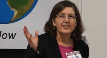
Meet Dr. Diane Wickland, Terrestrial Ecology Program Scientist
Job Title
Terrestrial Ecology Program Scientist
Dr. Diane Wickland
Education
Dr. Wickland received a B.A. degree from the University of Wisconsin - Madison (Botany) and M.S. (Botany) and Ph.D. (Biology/Botany) degrees from the University of North Carolina - Chapel Hill. She has conducted ecological research at the Savannah River Ecology Laboratory in Aiken, SC, and the Jet Propulsion Laboratory in Pasadena, CA. Research interests have included plant ecology, biogeochemistry, vegetation science, stress and disturbance effects, remote sensing, and global ecosystem dynamics.
NASA Professional Profile
The following is an edited oral history transcript taken from an interview with Dr. Dian Wickland on March 26, 2010. Please note: Considering the length of the interview, it may be best to jigsaw the questions with students so that the content is distributed among the class and can be meaningfully-reviewed within one instructional period.
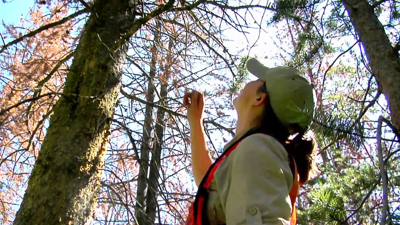
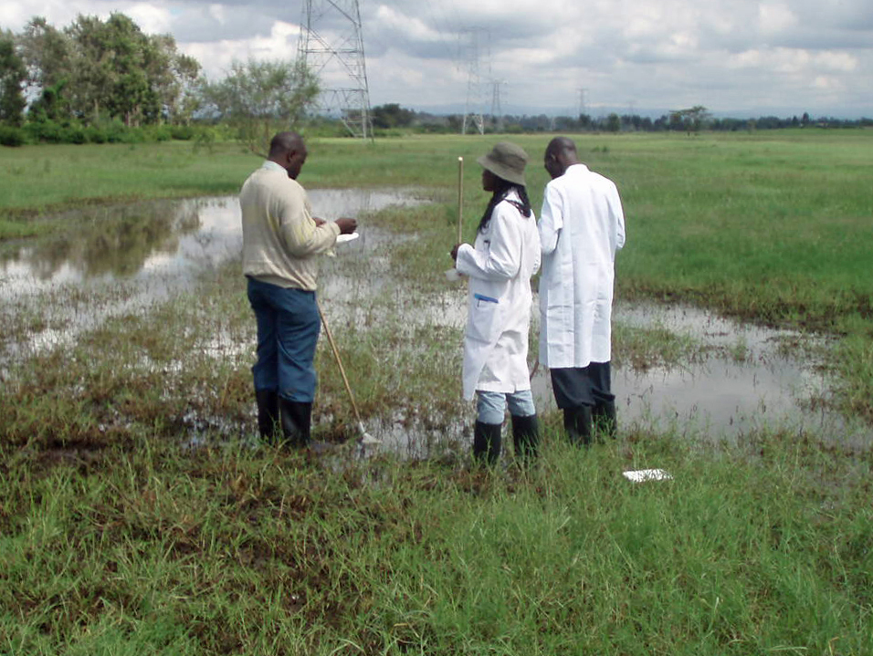
Dr. Wickland works at NASA Headquarters in Washington, DC, where she oversees the planning and implementation of NASA's Terrestrial Ecology research program and leads its Carbon Cycle and Ecosystems Focus Area. She coordinates research programs in land cover and land use change, ocean biogeochemistry, terrestrial ecology, and biodiversity. In these roles, she regularly seeks inputs from the ecological and remote sensing communities and builds partnerships with national and international research and space programs.
Wright: Today is March 26th, 2010. This oral history is being conducted with Dr. Diane Wickland who is currently the manager of NASA’s Terrestrial Ecology Program and has served in this position since 1987. This interview is being conducted at NASA Headquarters in Washington, DC, as part of the Earth System Science at 20 Oral History Project. The interviewer is Rebecca Wright, assisted by Sandra Johnson. We both want to again thank you for stopping your day and coming in to visit with us. We’d like for you to start by telling us how you first got involved in your field of expertise.
Wickland: I’ve always been interested in plants. I grew up on a farm. Of course, there were the crops and the garden, but the wild plants, the wildflowers, and weeds were always somewhat more interesting to me. When I went to college it didn’t take me long to find botany as the field I wished to specialize in. My questions then became more sophisticated, like trying to understand stress in plants and why some plants are weedy and common as opposed to rare and hard to grow.
That took me into ecology as opposed to other aspects of botany. It was interesting, I was just making that choice at the same time the first Earth Day occurred [April 22, 1970]. All of a sudden ecology became a word people recognized and knew about, even if they thought it meant environmentalism as opposed to a scientific discipline. When I started out, it was an esoteric, not well-understood field, but my career started moving along at the same time the environmental movement started becoming very visible and active.
I did my graduate work at the University of North Carolina at Chapel Hill and studied vegetation growing on abandoned—the word they used in the literature was derelict—mines. Heavy metals are toxic to many plants, and yet there were some plants that were thriving in these otherwise barren settings. I studied the ecological setting for those plants and was in particular interested in understanding which species responded to stress and what combinations of plants were different and unique there.
I didn’t connect up with NASA until I was nearly done with my Ph.D. One of the scientists at the Jet Propulsion Laboratory [JPL, Pasadena, California] named Barry [Barrett N.] Rock was doing research in a field called geobotany in the mineral exploration world. Geobotany means exploring for mineral deposits by using signals you might see in plants. Such signals might be the effects of stress that the plants show or potentially the species of plant that grows there and is more tolerant of those situations.
He discovered my work at one of the professional society meetings, and we started talking because he was interested in the heavy metal stress and the sites I was doing in North Carolina. That developed into an opportunity to apply for a postdoctoral [postdoc] position through the National Research Council [NRC] program; at that time they administered it for NASA. It was a NASA-funded postdoc but administered through the NRC. We still have a postdoc program, but a few years ago they changed the contractor and it’s no longer administered by NRC.
So I applied for a postdoc. That was an interesting time too because I was just getting my Ph.D. right after Ronald Reagan was elected President, and funding for environmental science, generally speaking, was just crashing. It was very difficult to find a job. People around me, myself included, applied for hundreds of jobs. I was very fortunate to have made that connection with Barry Rock and have the opportunity to apply for that NRC-managed postdoc. I got an offer. I might have gotten another postdoc offer; it was in the works when I accepted the other one. But I was happy to find a job. I was also happy to find a job that was going to be so stimulating.
I had not done any remote sensing-related research in my training, so getting into remote sensing was a new aspect for me. Talking to Barry initially, and colleagues of his at JPL later on, it just seemed like wow, you can look at ecosystems from larger scales, larger perspectives. You can do regional and continental studies, and also some of the new remote sensing technologies that were allowing you to do more than just identify a vegetation type. You might be able to say something about its chemical composition, or, in my initial areas of interest, stress. That was all pretty exciting, and it seemed like it might be a good career move and an opportunity.
At that time there weren’t very many ecologists at NASA, either at the [NASA] Centers or certainly at Headquarters, so that was also an interesting thing—an opportunity to have an impact, pulling two different things together. That’s how I got started. Then the only major shift in that trajectory was after a couple of years, probably too brief a period of time, I moved into management and stopped doing my own research. The program I manage, the scientists I interact with, the research directions we’ve defined are all still pretty much relevant to that broader set of issues, global ecosystems, how they’re changing, how they respond to change, what aspects of these systems can you measure from space. That’s what the program does. I’ve pretty much stayed engaged in the things that I’ve been interested in, but it scaled up rather fast both in the scale that remote sensing can address and my span of influence as a manager as opposed to a scientist.
Wright: I was reading some of the information. I know someone commented that they feel that you’ve been successful because no matter where you’ve been you’ve kept the heart of the scientist. I took that as the programs were still stirred by your concern of gathering scientific information. Do you feel like you were able to put projects with the people that you managed, those projects that made such an impact on the areas of research that you wanted to do as a scientist, before you took to management positions?
Wickland: I do, I do. In fact some of the people out there now are doing things I couldn’t have even imagined would have been possible. It’s interesting. Back in the late ’80s I would have said categorically you can’t remotely sense biomass. You can’t identify species from space. And we’re doing a bit of that right now. I could stand by my “you can’t identify species,” because you can only do it in certain settings and for species with certain properties, but remote sensing has advanced even well beyond what I could have imagined. That’s an interesting perspective I have as well.
The field started before I came here. I’m not going to take credit for getting ecology and vegetation science front and center in NASA’s contribution, but I will take some credit for growing it and solidifying it and making sure we got the best scientists and the best projects moving forward. That all started a little bit before I joined NASA, and in particular joined Headquarters.
Wright: How has the evolution of remote sensing and the changes in technology impacted your work?
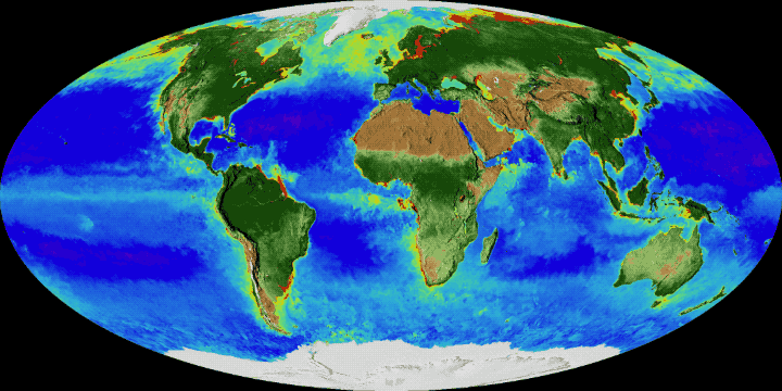
Wickland: It’s just had a huge impact. We went from a period of time from when I joined NASA, until the launch of the first EOS [Earth Observing System] platform, the Terra [satellite], when all we really had in terms of our own US remote sensing assets were Landsat [satellites] for some analysis of land cover, and the AVHRR [Advanced Very High Resolution Radiometer] sensor where you could do a two-band ratio called a vegetation index. Sometimes we used thermal channels. So we had two tools and maybe four or five different bands of spectral information to work with for two decades.
Then all of a sudden we had multiple instruments with dozens and dozens of different spectral bands and different spectral information. We had passive microwave. We had multiangle observations. We had observations of atmospheric gases that allowed us to trace the effects of forest fires. All of a sudden we had a whole bunch of new tools. We were able to better quantify the intensity, temperatures if you will, of fires. That enabled us to map the areas of different kinds of fires, for example, forest fires versus grassland fires. We were able to do many new things with these new tools that we were unable to attempt in the past, because we just didn’t have any other information than those two satellites and their few bands.
So there’s just been this huge blossoming of the things you can do with remote sensing, as well as the different types of data that you can put together. Either complementary information from two different satellites to understand something more fully, or completely different information that you can bring multiple independent sources to a single question and gain more leverage on it that way. It’s really changed a lot.
Wright: How about computer modeling?
Wickland: Computational capacity has, of course, also really made a difference. Modeling is a particularly good tool for the NASA program because remotely sensed data, being synoptic and global in its scope, can drive global models and large regional models. It is a rich data source for modeling. From the beginning, I felt investing in modeling was really crucial. We spent quite a lot of time and effort in developing models that were compatible with remote sensing inputs. We now have quite a few models out there that do that. Of course computational capacity has increased a lot, so that you can model dynamics and over longer periods of time, with reasonable amounts of computer time.
Back even in the ’90s if you wanted to run a year’s physiology in an ecosystem model you were running a model on a big computer for a couple of months. Now they can do it on their desktop in a couple of hours. It just opens up the kinds of questions you can ask. So that’s definitely been part and parcel of it.
Even more than just the modeling, in terms of how computational capacity has also changed and aided what we can do, is the fact that remotely sensed data is also large-volume data. Because it’s global because it’s synoptic because you may be getting finer spatial resolutions and many spectral channels, it’s large-volume data. Again, what used to take months or years to do now you can do in a day or a week. Being able to process and extract information from these huge volumes of data is now much easier, and that enables whole new sets of questions to be asked, even simple ones that you just couldn’t get at.
We’ve had Landsat for the longest time of any of the ongoing satellite series, but a global Landsat mosaic was initially impossible because of limited computing capacity, as well as, I think, just physically collecting the data from the ground stations. It is now something that you might do once every decade over a short period of time. It has changed from a huge effort over many years, to something we might be very close to doing on an annual basis. Right now we’re not quite there yet. It’s just simply the computational capacity and the ability to ingest and digest large amounts of data.
Wright: Is it easier to share this information now than when you first started?
Wickland: Oh yes. The Internet and the data system capabilities that have been developed over the years, in particular with the EOS project, have revolutionized how people access data, use data.
Wright: Do you feel like it increases the advancement of discovery or of analysis because you now have better tools and the ability to share globally that you didn’t have 20 years ago?
Wickland: Oh, absolutely. The scientists have, almost at their fingertips, access to whatever they need to tackle the next question. There are notable examples to the contrary, but for the most part they don’t have to spend too much time pulling in a new data source and prepping it to run their model or do whatever analysis they’re going to do. You can just go get it, and in some cases just use it. It’s not always that simple. Nor do I believe it should always be that simple, because it’s still a complex data type and you really need to understand the data, and what you’re doing with it, so as to make sure you don’t do silly things.
Too easy may not be a completely good thing, but scientists will still clamor for more tools and services to make ever increasing amounts of data and different data types readily available and readily useful. We’ve learned a lot of hard-won lessons over the years in what works and what doesn’t there.
Wright: In the mid ’80s, as you were getting started, the Earth System Science [ESS] concept was being talked about. In ’88 the Bretherton [Diagram] came out and the report “[Earth System Science:] A Program for Global Change” and the ESS program. Where were you at this point? Were you aware that these discussions were going on? What did you think about the concept of these scientists now starting to work closer together?
Wickland: I was not engaged in the NASA program at the very beginning of all of that, but my first boss here at Headquarters, Bob [Robert E.] Murphy was. He’s told me many a story about the beginnings, and there probably are many stories about the beginnings. But I came in pretty early on, so it was just fascinating to watch the whole thing unfold and blossom.
I was excited from the beginning. The idea of doing Earth System Science and the satellite measurements that went with it just seemed like it was a winner from day one. Yes we need to do this; yes this is going to be really important and useful. Looking at the Earth as an integrated system was a no-brainer. This is it, you can’t think of any more important scientific goal for the field. The science in particular—it was just yes, of course. And the only thing that you say is wow, could we really pull something that integrated and complex and large-scale off. So just wow.
I was at JPL as a postdoc in 1983. At that point in time, I don’t think Earth System Science was yet the buzzword. The buzzword was global habitability. I’m sure you’ve probably heard other people mention that. According to my friend Bob Murphy, that arose out of a couple of different lines of thinking, within NASA mainly, with heavy influence from the planetary part of the program. They talk about things like life on other planets and other systems, the habitable zone around a star. So there was some thinking that we should study the habitability of planet Earth. I think there was probably some growing recognition that environmental pollution and other things going on may be changing the system in some way, such that it makes it an even more compelling set of questions. That idea was floating around when I hit my postdoc.
I also remember going to a talk at JPL somewhere in the middle of that timeframe, probably ’84, from Shelby [G.] Tilford, who was the division director for whatever the Earth Science Division was called then, about “System Z.” This was a grand integrated satellite that became the EOS program. It started out as System Z. I was pretty wowed by the scope of that. I think I remember talking, sitting around the lunch table at JPL with some of the geologists there, and they were pooh-poohing—it’s too grand, it’s too ambitious, how could that ever get pulled off and so on. Not everybody was instantly thrilled, but I was impressed. I was impressed with the vision, and I didn’t have too much of a basis for assessing the practicality that early in my career anyway.
Those were my two first exposures, one, to the science, and two, to the satellite missions that NASA was envisioning that went with it. According to Bob Murphy, and the things I’ve gleaned from talking to other people, when we started talking about global habitability outside of NASA it was greeted with the “not invented here” reaction—why should we be interested in this? I think the people who wanted to really make a splash, create momentum for this big program, learned very quickly. Again I’m speculating because I wasn’t there firsthand, but this is the way it looked to me based on the things I’ve heard from other people in retrospect.
The NASA folks very quickly said, “Okay, we’ve got to sell these ideas in a different context. We’ve got to go do our homework with the other [national] agencies and the scientific community. We’ve got to do our homework internationally with our space agency partners and the international scientific groups—in particular the International Council of Scientific Unions, ICSU. After a couple more years of talking over these ideas of studying the whole Earth and using synoptic measurements, remote sensing, in combination with process studies on the ground and in situ networks, we could really begin to understand how the Earth functions and how it might be changing. ”
That began to take off. Simultaneously the seeds were laid for the International Geosphere-Biosphere Program [IGBP] that embraced the concept of Earth System Science and the research elements that were more biologically aligned. Very quickly there was a turf issue with the World Climate Research Program, WCRP, because they already had staked out the climate side of it, but the seeds were planted for those two programs to take on Earth System Science.
At the same time NASA, NOAA [National Oceanic and Atmospheric Administration] and NSF [National Science Foundation]—it was a multiagency effort—commissioned the Bretherton [Earth System Science] Committee that wrote the “Earth System Science” report. It was in the early days of thinking about that committee’s work that I think the term “Earth System Science” really started being more used.
Once that report was matured and people started briefing it out, even before it was published, Earth System Science really became the focus within the US research community. Global change started becoming the term that was used more internationally, but those two phrases started really characterizing a whole set of ideas. The Bretherton report and the planning for the satellite missions that would address the science in that report were developed in the mid to late ’80s. They engaged a really broad crosscut of the research community in the US and also internationally in one way or another.
We’ve done a lot of our planning in more recent years through the National Academy of Sciences, but Earth System Science wasn’t started that way. It was a group that was commissioned by the several agencies and then reached out to the broad community and pulled people in, and was really more bottom-up and grassroots than things that come out of the Academy. I personally think that was the reason for the success of those programs. One, you got really broad input and perspective so you knew the community’s interests and best thinking was engaged, and two, you had the whole community buying into the idea and the imperative to tackle such a large program. In retrospect I’m even more impressed with the process than I was at the time because back then I was quite young.
I attended many of the Bretherton committee’s meetings. Not all of them but more in the later stages—it seems like it was developed over a couple years. I don’t actually remember how long it took.
Wright: I think it did. They actually started in ’83. That was their first meeting and they published that first report in ’88.
Wright: What are some of the key elements or decisions, events that occurred that you believe provided that current direction and the correct direction for the Earth System Science?
Wickland: In the earlier days I really don’t know. I don’t have too much insight there. I think there was a growing recognition that probably got spawned by the environmental movement and Earth Day, that we’re changing our planet in bigger ways than one could have imagined people were able, and what are the implications of that? I think that was a key element to nonscientists, and even scientists, but nonscientists buying into the fact that we really needed an integrated program to study the Earth system. That if you have concerns about it changing, maybe you’d better learn as much as you can.
I think that was a pretty key ingredient. It was probably also important to keep it very scientifically focused, as opposed to focus on solving those environmental problems because you can take the high road with science and avoid some of the political quagmires that follows when people care passionately and differently about environmental issues. Avoiding some of that, not all of that but some of it, was helpful. Keeping it scientifically focused, I think, was good for the politics, as well as good for bringing on the international community. Recognizing that the Earth is changing, I think, was a key ingredient for keeping the importance of it front and center.
I don’t know what other early events might have made a huge impact on the decisions there. I guess the fact that we were initially encouraged. You know how NASA is when it’s trying to maximize its impact in an area. One of the things NASA was encouraging everybody was to use the Shuttle as much as possible. The decision to go that path, or the pressure to go that pathway, to use the Shuttle deployment and have missions be serviceable for the satellites, meant that we were going to have a big platform with lots of instruments and all our eggs in one basket. But really large satellites with many instruments, complexity and cost usually have associated big issues.
There were a whole set of things that happened because of the decision to go with a large platform, or in the end a set of rather large platforms. This probably had a really huge influence on some of the technical issues we had to address, some of the problems we encountered, both in the near term in developing the mission, as well as in the longer term in terms of trying to continue it. That decision [to go with Shuttle deployment] probably shaped what happened in the NASA part of Earth System Science, the satellite part of the program, a lot. I don’t know if we would have gone that direction without that pressure.
But I wasn’t that close to it. At the time it seemed like that had a huge impact. Of course, it also delayed some things after the Challenger accident. There was always budget scrutiny, and there was always political interest. I think we had three different reviews by the National Academy of the integrated program. There was a heavy focus on the satellite missions and the data system for EOS because they were very expensive. Politicians, decision-makers in the executive branch, had a lot of questions like the following: is this the right way to go, are these really cost-effective, are we really going to get the science? So three Academy reviews were sprinkled through the 1990s. I think one was called restructuring and one was called rebaselining. I can’t remember what the other one was called, but it was “re” something. They managed to avoid the word descoping, but in all cases, the program got tightened up and some things were dropped from it in order to meet the budget expectations of the day or to address anything less centrally important. Those continuous reviews also shaped the program. Not in a major way, but in ways that did matter.
Wright: What do you feel have been the results now that this concept has been in place for 20 years and information has been shared, and people feel more of a unity of working on this? What do you feel have been the greatest impacts on your field, and of course on Earth System Science as a whole?
Wickland: I think the biggest impact is that we documented significant changes occurring on this planet that are not natural system variability or natural system change. They’re things that people did and are doing to the planet. We’ve observed it. We’ve quantified it. We’ve demonstrated trends, changes in rates, acceleration of certain phenomena. We’ve actually documented that.
Back at the beginning we had the sense that things were being changed and there were impacts, but we really didn’t know how large, how important, or what the implications were for the future. Now of course, by documenting the scale and scope and nature of some of these changes, we have a better sense of their implications. Of course we’ve also been developing the models, and have been attempting to make predictions or develop scenarios that could give us some sense of what the future would be. We’ve provided all that context.
Despite all the ridiculous controversy out there in the press about whether global change is real or not, this program, Earth System Science, the whole national and international effort—this program documented it and quantified it in so many different ways. It’s truly remarkable. All by itself, just the fact that we now have the knowledge, and we have a better sense of the implications, I can’t think of anything else that would be more important than that. There are a lot of other things that you have to consider accomplishments, like being able to do so many more things from remotely sensed data than before, that have just really advanced the science.
We’ve been able to pose entirely new, scientifically interesting questions about how ecosystems work, about the planet’s functioning, and what might be important changes to watch out for in the future. We didn’t necessarily discover this with remote sensing, but as an ecologist, when 20 years ago we were talking about the effects of increasing carbon dioxide in the atmosphere, there’s what they called the “indirect effect” of carbon dioxide. It causes the greenhouse effect that in turn raises global temperatures. But for vegetation on the land, there’s also what they call “direct effect” in that CO2 [carbon dioxide] is taken in by plants to make sugars and starches and store energy. It’s a fertilizer of sorts; it’s the building block of vegetation.
When CO2 increases in the atmosphere, it’s easier for plants to absorb it. It’s less limiting in some systems, so plants might grow more. So how the whole ecosystem responds—does it get more productive everywhere or do other factors that limit vegetation growth then take over after a certain point? We’re still arguing about that and doing scientific studies, and it seems like in different systems there’s more or less fertilization effect. What the net effect on the whole planet is, is still not settled, but it was clear that we had to look at the CO2 fertilization question as well.
But when I talked to the oceanographers and asked if there was anything like that going on in the ocean, the answer was, “Oh, no, no, no, no direct effects of CO2 in the ocean.” It just diffuses in and out according to the concentration gradients in the ocean versus the atmosphere. The phytoplankton doesn’t grow more biomass or anything; it’s pretty much just cycling constantly. Then about three, four, five years ago, all of a sudden it became clear that well, yes, the gradient is steeper, there’s more CO2 going into the ocean, and the pH of the ocean is changing. It’s becoming more acid, and acidity is going to have huge impacts on which organisms are able to grow where. In particular, organisms that put calcium carbonate into their shells, into their exoskeletons, are going to have a harder time doing that. In fact they might just dissolve away in a more acid ocean.
Now there are these huge concerns about direct effects of CO2 in the ocean. Remote sensing didn’t discover that, but it was part of the grander picture of building more and more understanding about what’s going on in the general system. We’ve learned whole things we weren’t even worried about that have led to very interesting questions that we weren’t asking before, like what are the prospects for coral reefs, and the organisms that have these calcium carbonate shells, in a changing climate and CO2-rich world. The science has advanced enormously in terms of understanding the parts of the system we need to understand and what aspects of the system we need to understand.
You could also say the same thing about the field of remote sensing. We understand the biophysics of remote sensing by having all these new measurements and new instruments and methodologies for making measurements. We, of course, advanced that field enormously too in terms of understanding the biophysics of remote sensing, how electromagnetic radiation interacts with the Earth’s surface and so on. We’ve become very sophisticated in what we can do with that kind of data.
Wright: You were talking about the advantages and the impacts. What do you believe some of the greatest missed opportunities were? Twenty years have gone by. What else could have been done that had an opportunity but it just slipped by?
Wickland: I think the biggest missed opportunity was to solidify the global observing capacity for being able to regularly and routinely monitor, observe the Earth system, and continue to document changes, to continue to discover new phenomena of import. The grand vision for EOS and Earth System Science was that we were going to measure the same things quantitatively over—for EOS it was 15 years and three cycles of satellites carrying the same instruments. And working with international partners have an even broader set of observations than those, including the in situ observations that you need to help interpret those data, as well as to measure things you can’t measure from space. That was part of the grand vision. I think it was within our reach as a nation to do our part, and we dropped the ball. We dropped the ball. We only got one set of platforms; we didn’t get the three sets of platforms because budgets got slashed. The powers that be at the time were saying, “Oh that’s old technology. NASA can’t fly old technology. NASA is an R&D [research and development] agency, we don’t do monitoring. We develop the first thing, show what’s possible, do our science, and move on.”
That’s okay. It doesn’t have to be NASA, but the fact is that we couldn’t transition those quality observations to NOAA or USGS [US Geological Survey] in the systematic complete way that you would want to do if you wanted to solidify them in the operational domain. We are doing a little bit. USGS is in transition to taking on the Landsat time series. We’ve got some of the observations secured, we think, in what was the NPOESS [National Polar-orbiting Operational Environmental Satellite System] program and is now transitioning to the Joint Polar Satellite System between NASA and NOAA with the Department of Defense going its own way. A little bit of progress may have been made there, but basically we do not have the continuity of observations to continue documenting and studying global change and using the time series of information to help us diagnose further what’s happening.
It’s just a huge missed opportunity because it would have been easy to keep going, and now it’s like starting over. Even worse, the new NRC decadal survey, while giving us a whole bunch of exciting new missions for Earth science, really doesn’t give us the systematic time series. This is partly because the NRC was asked to do something else, but I feel like we couldn’t have screwed up more as a nation. Not as an agency, because I don’t think this is NASA’s fault totally. It’s the United States’ fault. In fact the Europeans and Japanese are doing a better job of providing continuity in their time series than we are in ours right now—much better. To that extent, we’re losing some of our leadership position in the world because of that. So no-brainer, nothing else is close.
I also do think that there were some opportunities to better integrate the US investment in global change science across the agencies, the things we do across the agencies. The US Global Change Research Program did a wonderful job of creating an infrastructure whereby the agencies can talk to each other and coordinate. It actually works, but it doesn’t work as well as it could. It’s still more important when you’re making budget decisions and what to ask for in subsequent year’s budgets. It’s much more important to look at the agency’s mission and its priorities than it is to look at the nation’s priorities and what we could do together. While we’ve made strides, I don’t think the US government has ever done better in integrating across its many agencies’ programs. We could have done more, we could have done more.
If we’d done more across the agencies, maybe we would have done a better job of not solidifying the space-based observational time series, but we might have done a better job of securing the in situ observational capabilities. It’s the hardest thing to sell, making continuous measurements. When agencies commit themselves to that, it’s for their own very specific needs and things that they may have been mandated to do. There are gaps between what the USGS measures, versus what US Forest Service measures, versus what NASA or NOAA would measure. We could have done a better job there; it would have helped us a lot. That’s a missed opportunity too.
Wright: I was going to ask you about the challenge, but I guess part of the challenges that you encountered along the way is working with all these different agencies and all of them having their own missions. Did you encounter other types of challenges trying to pull these partnerships together for one vision?
Wickland: Yes. The interagency stuff isn’t too bad except when people start competing for the same job. Everybody wants to get the new work, but short of that, we all have pretty much goodwill, in the community I interact with at least. The more you understand about each other’s programs and missions and constraints, the more you can actually use those strengths and weaknesses together. Like NASA can’t do this, but DOE [Department of Energy] can do that. DOE can’t do this, but NASA can. You work deals where you get everything done by going with whoever has the best capacity to do the work.
We don’t do too badly there. Competing for new money though, that’s a little bit less fun. Then you start having interpersonal issues. I’ve often said that once you get a PhD as a scientist, all of a sudden you’re expected to have skills that you were never trained for, managing a budget, managing people. A lot of people who become scientists don’t have the best interpersonal skills, so working with scientists, it seems like every now and then bad behavior can really poison some things. That’s the thing I live most in terror of, because it’s the thing I’m least able to deal with, because I’m not skilled at making peace or whatever is needed.
But that’s just people, and I suspect everything you might do you’re going to have those kinds of issues. This is in some ways a positive challenge, but people oftentimes don’t recognize how challenging it is. That’s communicating across scientific disciplines, or between scientists and engineers or IT [Information Technology] specialists. It’s amazing how long it takes before you actually understand each other. All of these fields have their own jargon and lexicon. Plain English language words you could look up in the dictionary don’t mean the same thing when an IT guy says them; they mean something more specialized.
Plus people tend to look at the world a little differently and put information together in different ways. So just achieving complete communication as you’re beginning to work together is really challenging. I’ve been in groups whereby it can be three years before someone really fundamentally understands the issue that the other guys were talking about. It’s not that people aren’t smart and clever, it’s just that you’ve got to build up a new perspective on the topic. You’ve got to understand the lexicon of the other guys, and then you’ve got to think through the implications. And all of a sudden after three years, “Oh, now I understand why you want to do it that way or you can’t do it that way.” It’s amazing!
Wright: It all comes together.
Wickland: Once you’ve done that, once you’ve gotten there, all of a sudden it’s like one of the last barriers to really being effective together is gone. You can do amazing things when you bring all those experts into the same problem-solving setting, so it’s worth the investment, but I don’t think people sometimes understand how long it takes or how hard you have to listen. I can’t tell you how many times someone has said something five times over the course of a year in the same discussion before I realize I’m not getting it. It’s just interesting, and it’s important. It’s a big challenge, but if you’re going to do Earth System Science you’ve got to get there.
Political issues connect up with the science we do a lot, and pose a lot of different challenges. Your scientific findings become controversial or contentious just because people want to use them to make different points, or minimize your contribution or maximize your contribution because it helps them make a point. It’s a challenge and a complication, and scientists don’t do too well with some of that either. At Headquarters this is a very political environment. That’s why I have absolutely zero aspirations to rise any higher in the hierarchy, because you get further away from the science and you’ve got to deal with more of the politics. I don’t care for that a lot, but it is something that’s a reality in Earth science. It makes it a little harder to just enjoy your discoveries and findings, because they have all these implications and differing perspectives on whether you’re doing good or bad work. I find that a big challenge, and I think some of the scientists in the community do too.
Wright: Are there some other notes, or some other thoughts that you want to add before we close out today?
Wickland: I spent a lot of time thinking about the past 20 years of Earth System Science last June when that [NASA Earth System Science at 20] Symposium was planned, partly because I missed it. I had committed to give a plenary talk at a remote sensing meeting long before the dates got picked here, so I was really disappointed. I was disappointed to not hear other people’s perspectives and I was disappointed not to see some of the key players from the good old days like Shelby Tilford. I was disappointed to miss it, but I ended up thinking a lot about it. It’s not at the scale of a golden age, but in terms of my lifetime and in terms maybe of this type of science from space, developing Earth System Science and deploying the EOS satellites really was a golden age. It was exciting, it was stimulating. Everybody was working together towards the same goal. The problems were huge but there was no unwillingness to tackle them, and in the end we did pretty well.
I’m still amazed to this day that our data system didn’t do us in, because I didn’t think we were going to get through it. Looking back it was an amazing thing, and it seemed like NASA was doing something different and special then. Now, NASA is just another government agency. We’re more weighed down by our bureaucracy than we are uplifted by our aspirations. It was a neat time, and I’m glad you’re trying to document that.
Wright: We hope to be able to gather more from people like you who have been through the time period to see the division that first started and then how it’s come about to bring in impacts and changes. Thank you. We appreciate your time and your thoughts this morning.
Wickland: Thank you. It is sometimes fun to look back and be a little bit more reflective. I enjoyed doing that.