Grade Level: 6-8,
9-12
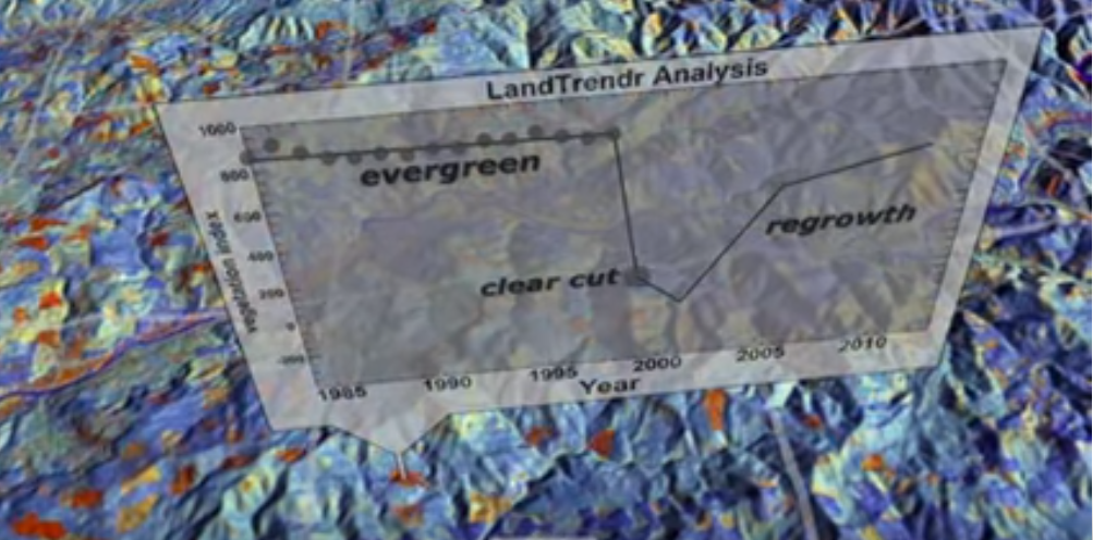
This mini lesson focuses on Landsat satellite data and how it is used to detect changes in land use.
The Geosphere is associated with solid portions of the Earth. It includes the continental and oceanic crust and all other layers of the Earth's interior. This includes all rocks, sediments and soils, surface landforms and the processes that shape the Earth's surface.(source #12)
This mini lesson focuses on Landsat satellite data and how it is used to detect changes in land use.

Examine the images to see the projected differences in land use between 1900 and 2100.
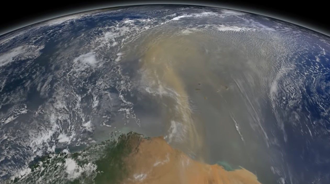
This mini lesson engages students in watching a NASA video related to accumulated dust that makes the trans-Atlantic journey from the Sahara Desert to the Amazon rainforest using NASA's CALIPSO satellite.