GLOBE Connections
GLOBE Connections: Changes in Land Surface/Land Use Change
GLOBE protocols and learning activities that complement the Changes in Land Surface/Land Use Change phenomena through hands-on investigations are detailed below. Students can conduct their own investigations and see how their data related to global patterns by using GLOBE and My NASA Data together.
Visit the GLOBE Geosphere Protocols & Related ESDE Datasets page that outlines the datasets available in the Earth System Data Explorer. These data complement student GLOBE investigations using the following protocols.
Changes in Land Surface/Land Use Change
Protocols
GLOBE protocols can be used to collect many types of data to examine land surface and use. Students can use the protocols to collect data and share their data with other GLOBE students around the world. As scientists continue their study of land surface and land-use change, they can use these data.
Source: (GLOBE Website)
Biometry: Measure and classify the plant life present at a Land Cover Sample Site to help determine the MUC classification.
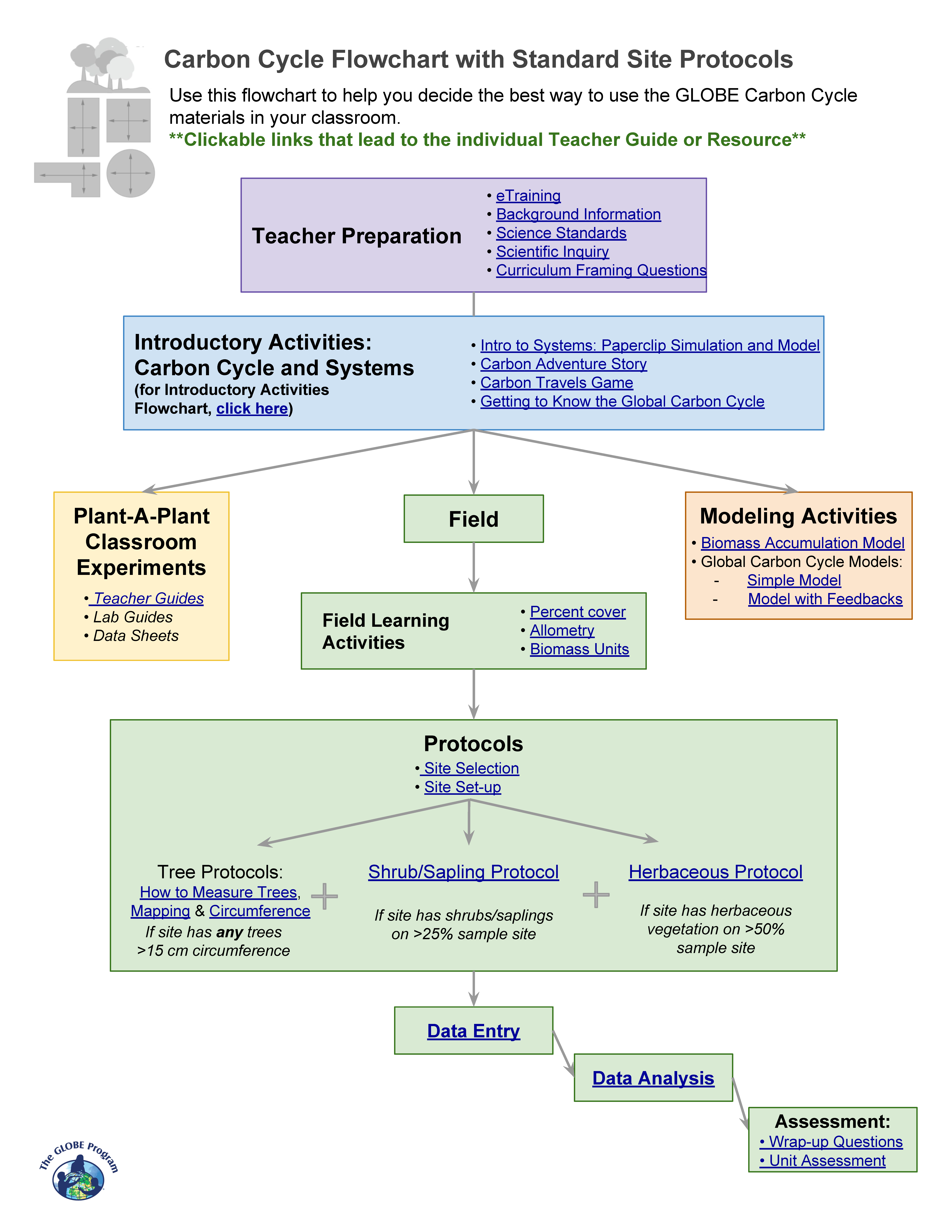
Carbon Cycle: Students learn necessary skills and work in teams to set-up a carbon cycle site. Determine which vegetation types you will measure at your site. There are decision trees available to facilitate decision making as well as a variety of carbon cycle learning activities and protocols.
Source: (GLOBE Website)
Fire Fuel: Measure the different types of fuels (i.e., dead branches, logs, live shrubs and trees for fires in land cover sample sites.
Land Cover Classification: Determine the major land cover type at a Land Cover Sample Site.
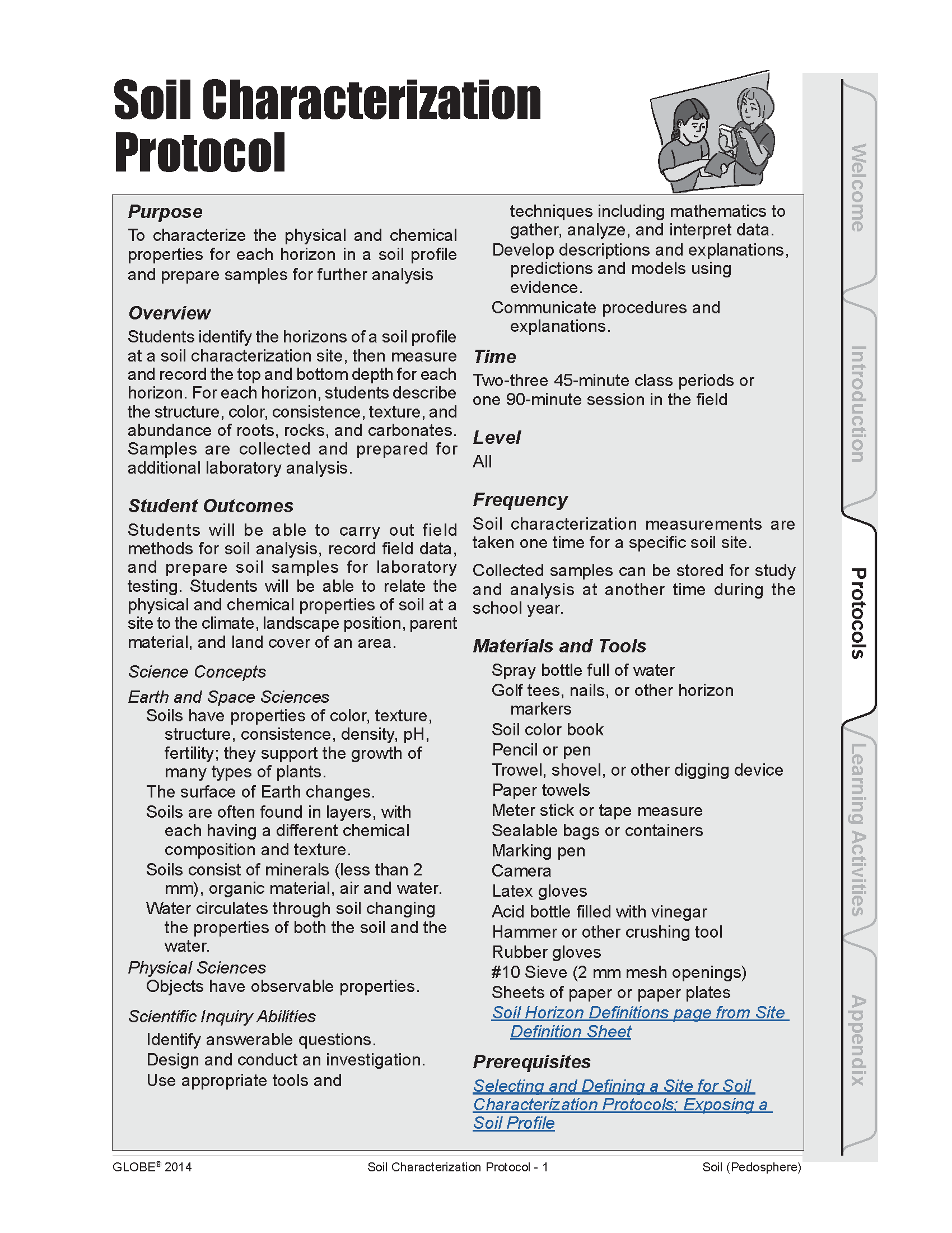
Soil Characterization: Students will identify horizons in a soil profile, observe the structure, color, consistency, texture, and the presence of rocks, roots, and carbonates of each horizon, and take samples for use in laboratory characterization protocols.
Protocol Bundle
The urban protocol bundle can be used with Changes in Land Surface/Land Use Change.
Urban Protocol Bundle - The purpose of the Urban Bundle is to suggest a group of GLOBE protocols that can provide students and teachers with integrated knowledge of the environment in urban areas, including various processes and their interactions. Given the many small-scale variations caused by the built environment, such citizen science contributions are particularly needed to adequately characterize the urban environment.
Learning Activities
Check out the three learning activities to help prepare students for collecting data and to support the integration of MND with GLOBE in your curriculum.
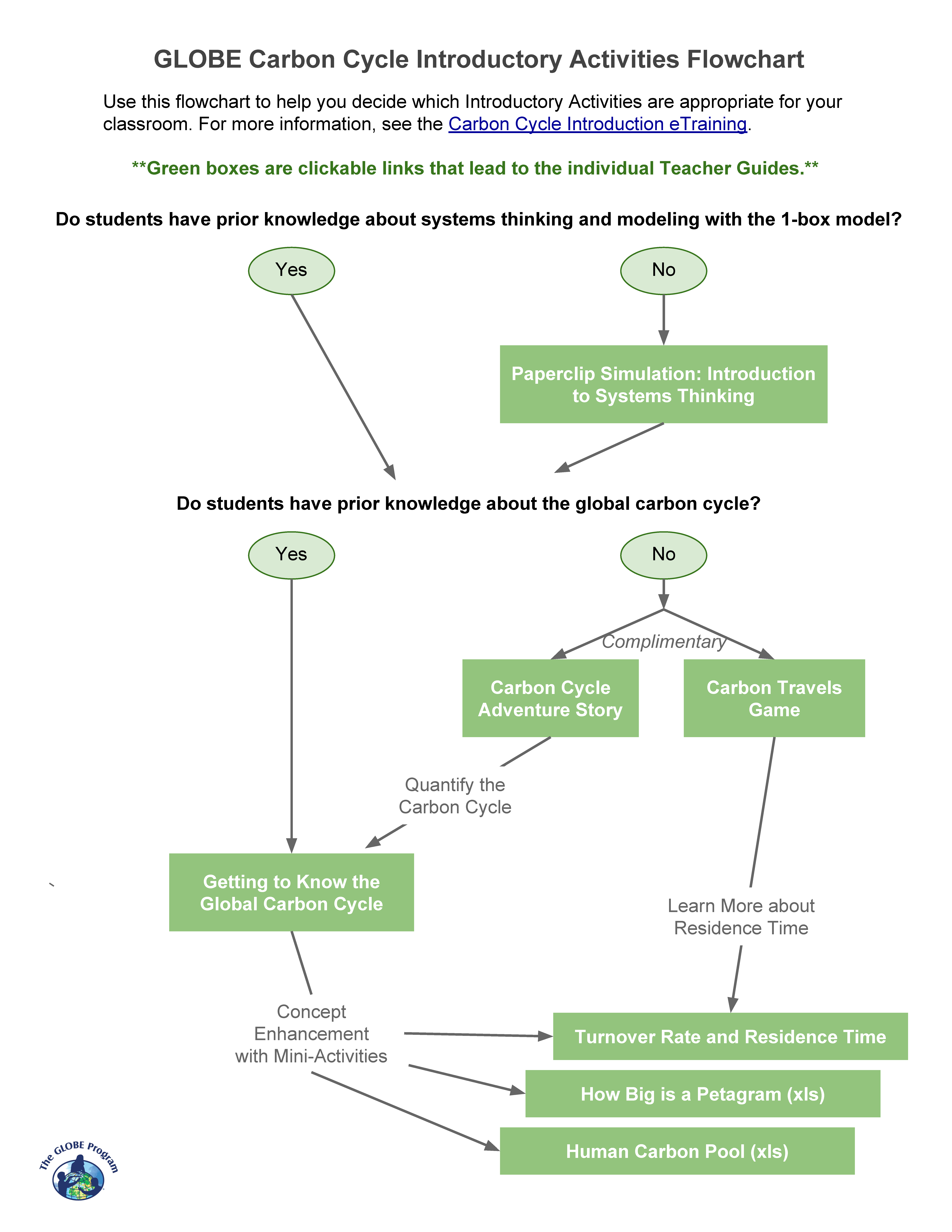
Carbon Cycle Introductory Activities Flowchart
Use this flowchart to help you decide which Introductory Activities are appropriate for your classroom. For more information, see the Carbon Cycle Introduction eTraining.
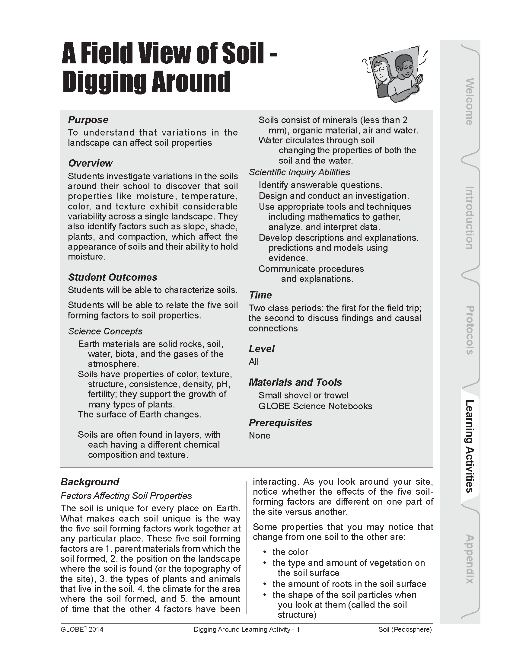
A Field View of Soil - Digging Around
Overview: Students investigate variations in the soils around their school to discover that soil properties like moisture, temperature, color, and texture exhibit considerable variability across a single landscape. They also identify factors such as slope, shade, plants, and compaction, which affect the appearance of soils and their ability to hold moisture.
Student Outcomes:
- Students will be able to characterize soils
- Students will be able to relate the five soil forming factors to soil properties
- Earth materials are solid rocks, soil, water, biota, and the gases of the atmosphere
- Soils have properties of color, texture, structure, consistence, density, pH, fertility; they support the growth of many types of plants
- The surface of Earth changes
- Soils are often found in layers, with each having a different chemical composition and texture
- Soils consist of minerals (less than 2 mm), organic material, air and water
Image Credit: NASA
Overview: Using Multispec software, evaluate and investigate changes that have occurred in the major land cover types of your GLOBE Study Site by examining the digital files of two Landsat satellite images that were acquired a few years apart.
Student Outcomes:
- Earth has many different environments that support different combinations of organisms
- All organisms must be able to obtain and use resources while living in a constantly changing environment
- All populations living together and the physical factors with which they interact constitute an ecosystem
- Humans can change ecosystem balance
- How to use maps (real and imaginary)
- The characteristics and spatial distribution of ecosystems
- Use land cover data and appropriate tools and technology to interpret change
- Gathering spatial data and historical data to determine validity of change hypotheses
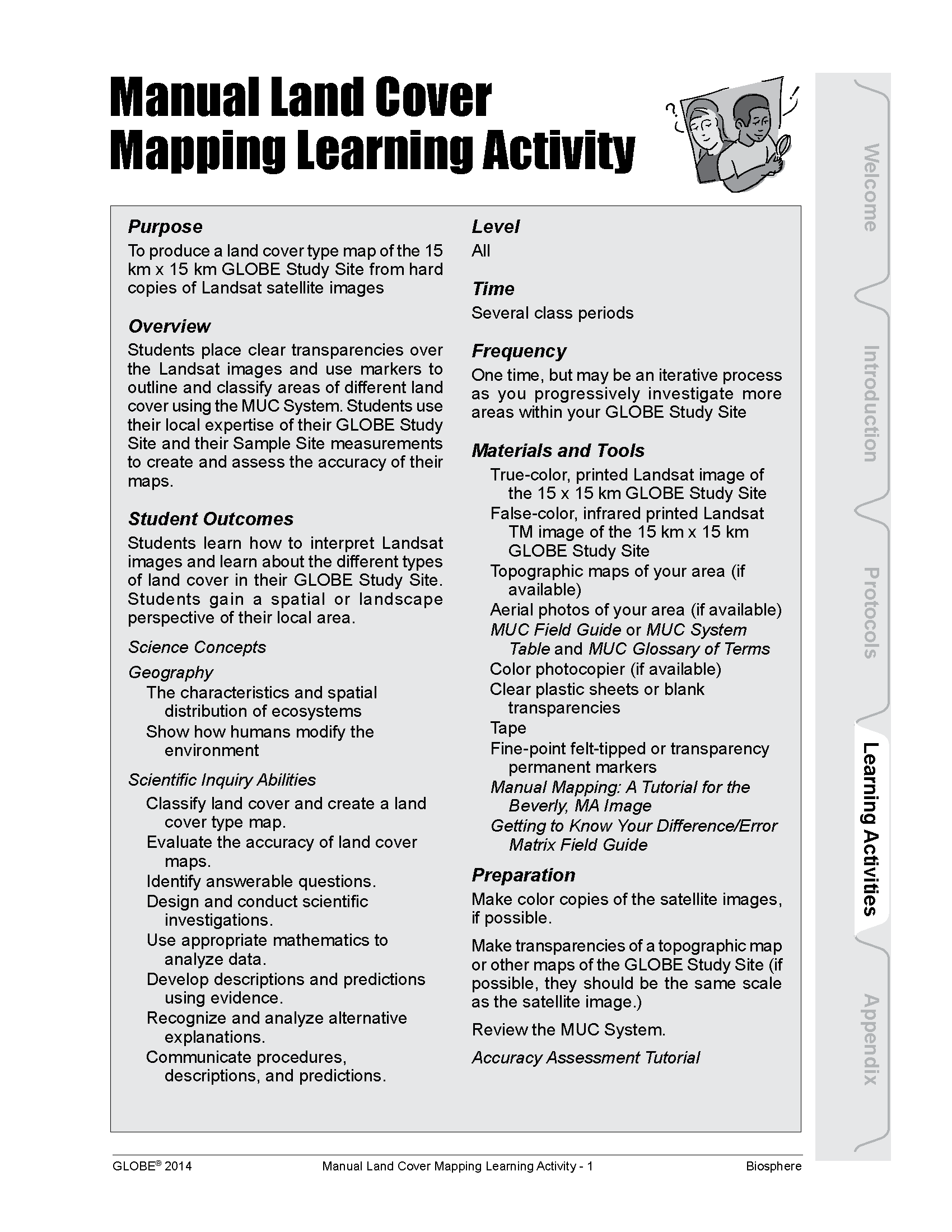
Overview: Produce a land cover type map of the 15 km x 15 km GLOBE Study Site from hard copies of Landsat satellite images
Student Outcomes:
- Describe characteristics and spatial distribution of ecosystems
- Show how humans modify the environment
- Classify land cover and create a land cover type map
- Evaluate the accuracy of land cover maps
- Use appropriate mathematics to analyze data
- Develop descriptions and predictions using evidence
Odyssey of the Eyes
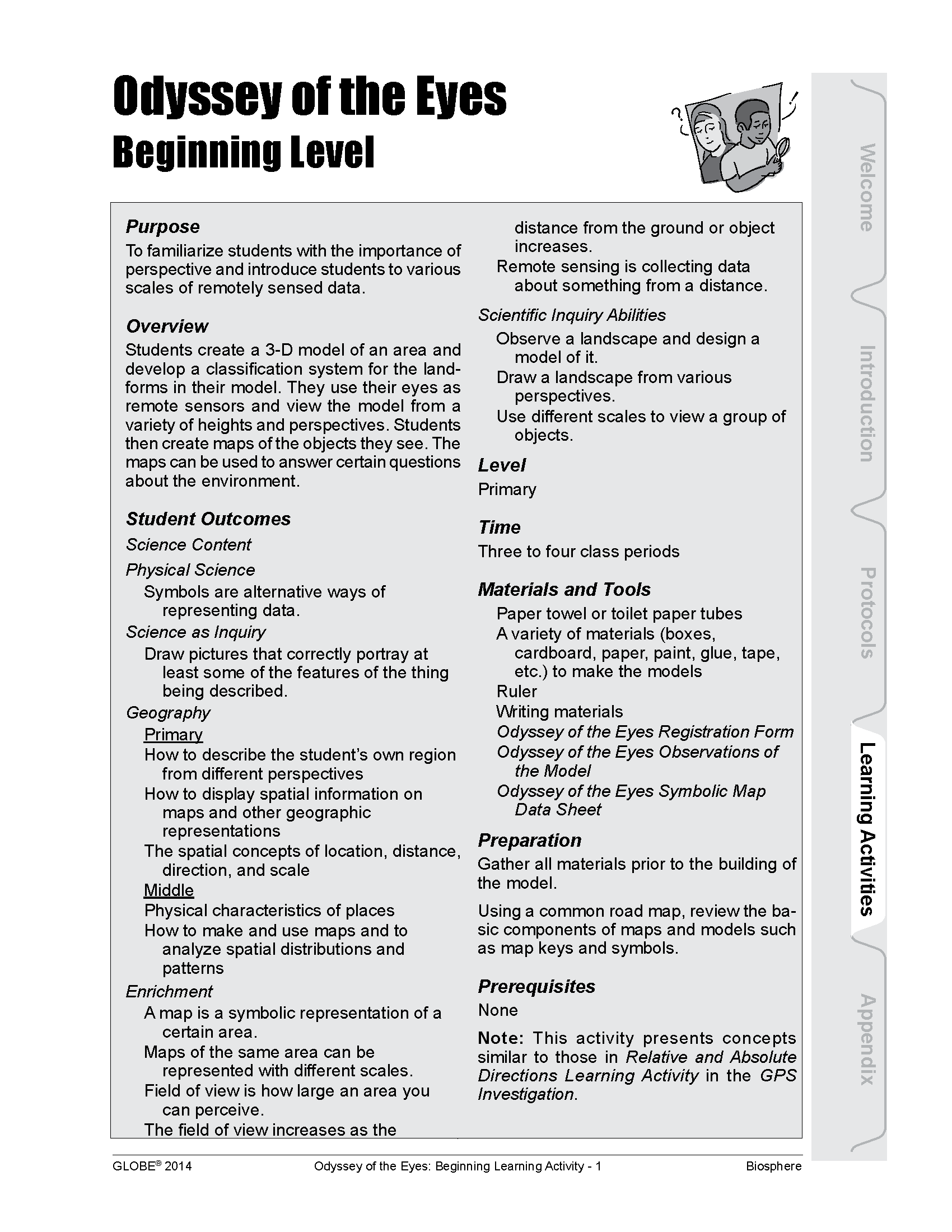
Overview: Familiarize students with the importance of perspective and introduce students to various scales of remotely sensed data.
Student Outcomes:
- Symbols are alternative ways of representing data
- Draw pictures that correctly portray at least some of the features of the thing being described
- How to describe the student’s own region from different perspectives
- How to display spatial information on maps and other geographic representations
- The spatial concepts of location, distance, direction, and scale
- Physical characteristics of places
- How to make and use maps and to analyze spatial distributions and patterns
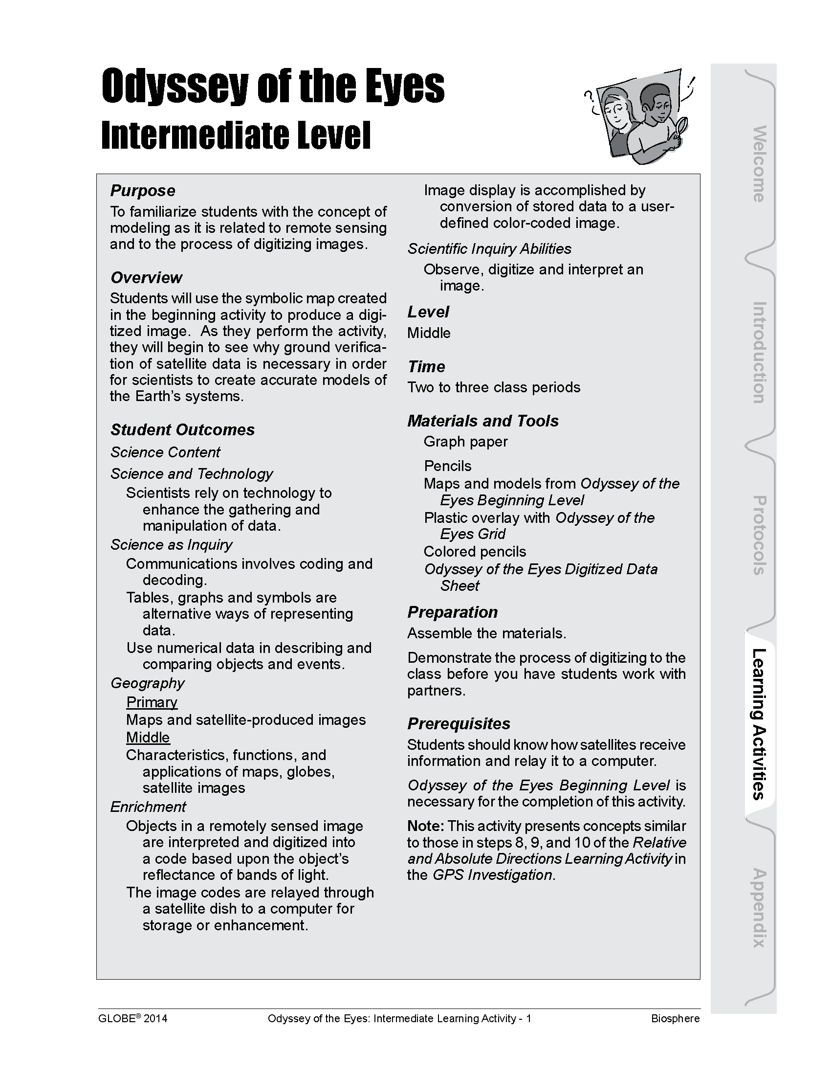
Overview: Familiarize students with the concept of modeling as it is related to remote sensing and to the process of digitizing images.
Student Outcomes:
- Scientists rely on technology to enhance the gathering and manipulation of data
- Tables, graphs and symbols are alternative ways of representing data
- Use numerical data in describing and comparing objects and events
- Maps and satellite-produced images
- Characteristics, functions, and applications of maps, globes, satellite images
Overview: Help students understand the connection between remote sensing technology, computer imagery and land cover assessment and to demonstrate how a satellite sensor relates information to a computer
Student Outcomes:
- Clear communication is an essential part of doing science
- Communications involves coding and decoding
- Tables, graphs and symbols are alternative ways of representing data
- Maps and satellite-produced images
- Observe, interpret and classify an image using the data given
- Analyze how the image interpretation might differ between groups
Overview: Students will understand the geologic phenomena of weathering and erosion. These processes, along with deposition, shape our landforms and contribute to the development of parent material in the soil formation process.
Student Outcomes:
- Understand the causes and variables that contribute to weathering, erosion, and sediment and mineral deposition
- Make observations and/or measurements to provide evidence of the effects of weathering or the rate of erosion by water, ice, wind, or vegetation
- Use models to describe a scientific principle or illustrate the relationships between systems or between components of a system (More specifically, model shapes and kinds of landforms in an area, interactions between land, air, water, and organisms, and the cycling of Earth’s materials)
- Explain cause and effect mechanisms with models in the classroom and then draw similar conclusions to naturally occurring events in the environment (
- Construct a scientific explanation based on evidence for how the uneven distributions of Earth’s mineral, energy, and groundwater resources are the result of past and current geoscience processes
Overview: Introduce students to the importance of soil and why it needs to be studied.
Student Outcomes:
- Understand the importance of soil science
- Be able to provide reasons for studying soil
- Understand how soil properties are determined by the five soil forming factors
- Appreciate the relative amounts of usable soil that exist on Earth
- Soils have properties of color, texture, structure, consistence, density, pH, fertility; they support the growth of many types of plants
- The surface of Earth changes


